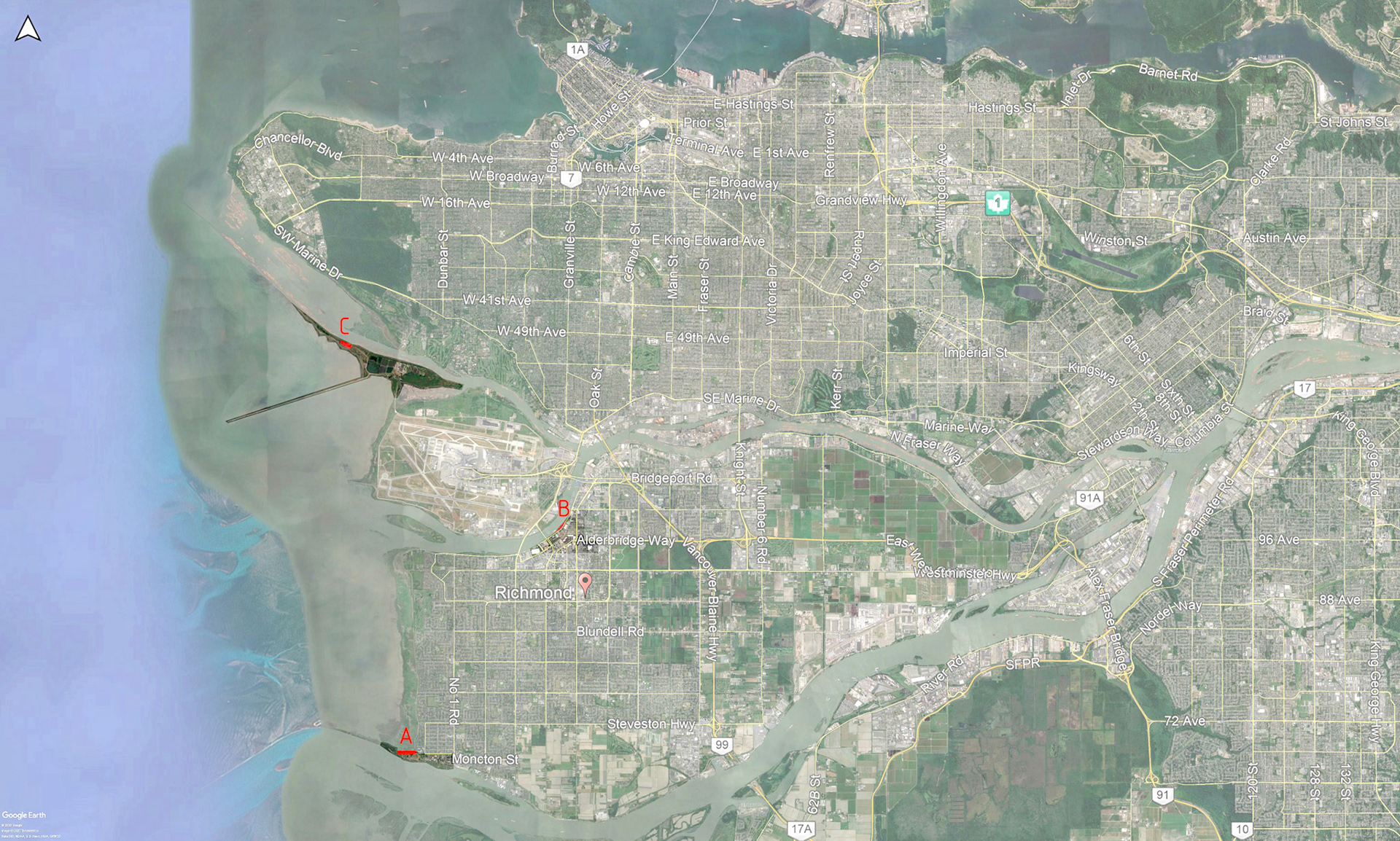
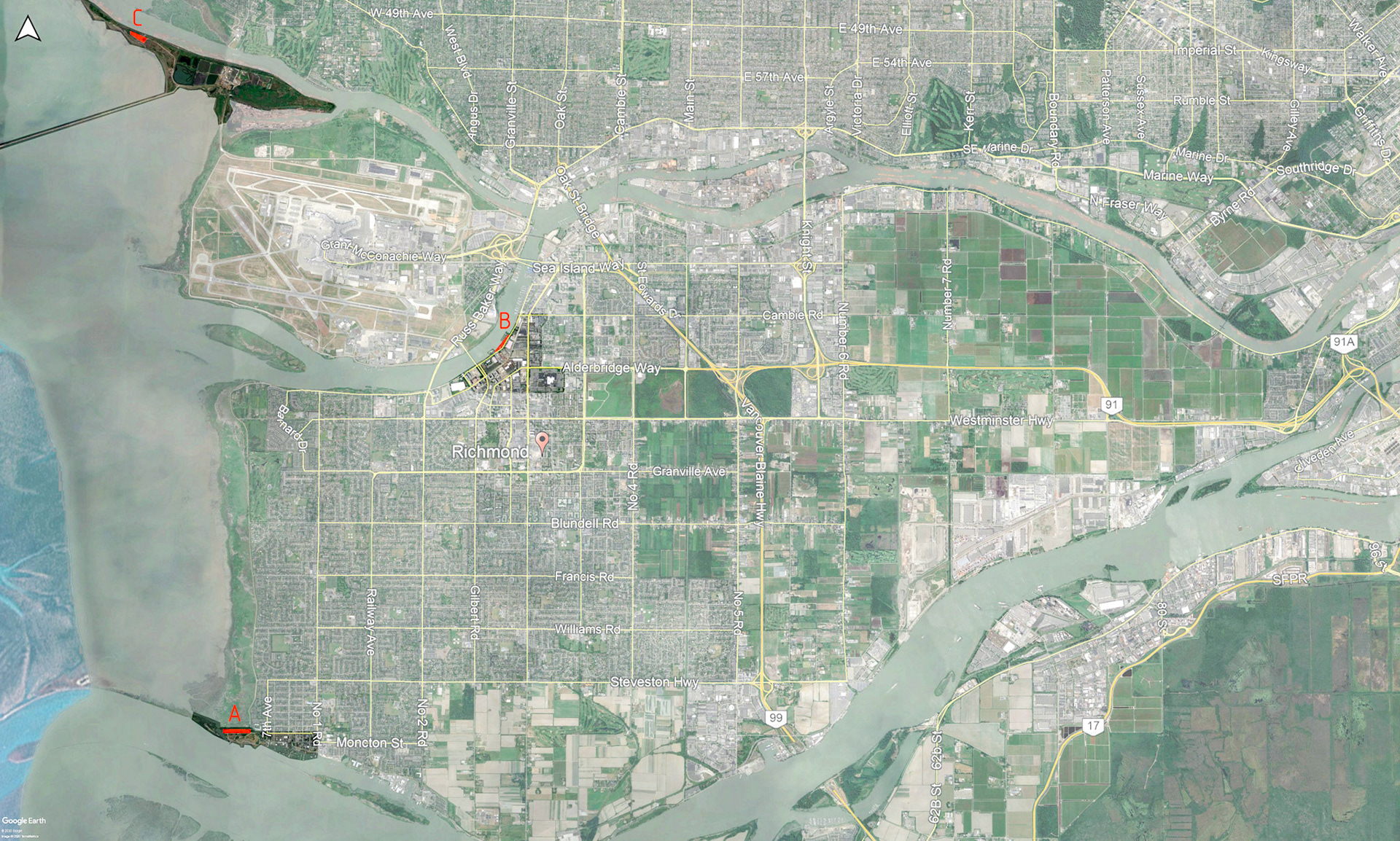
Site A
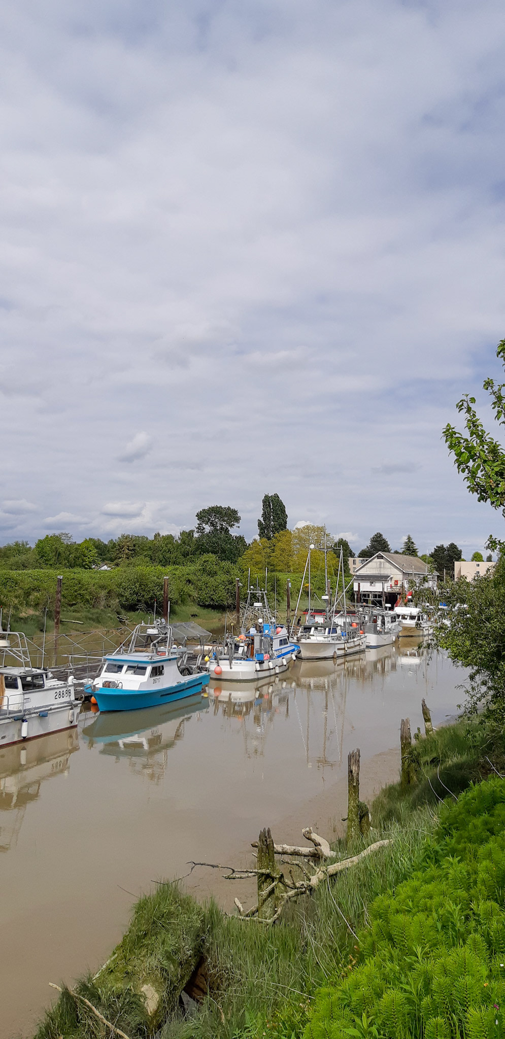
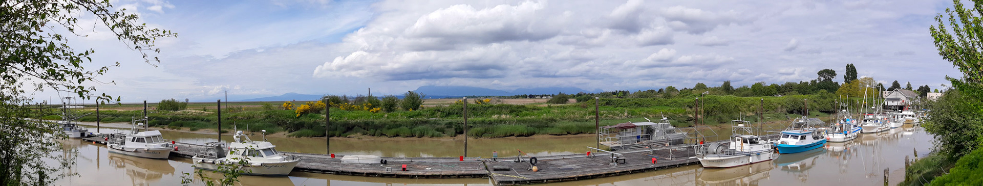
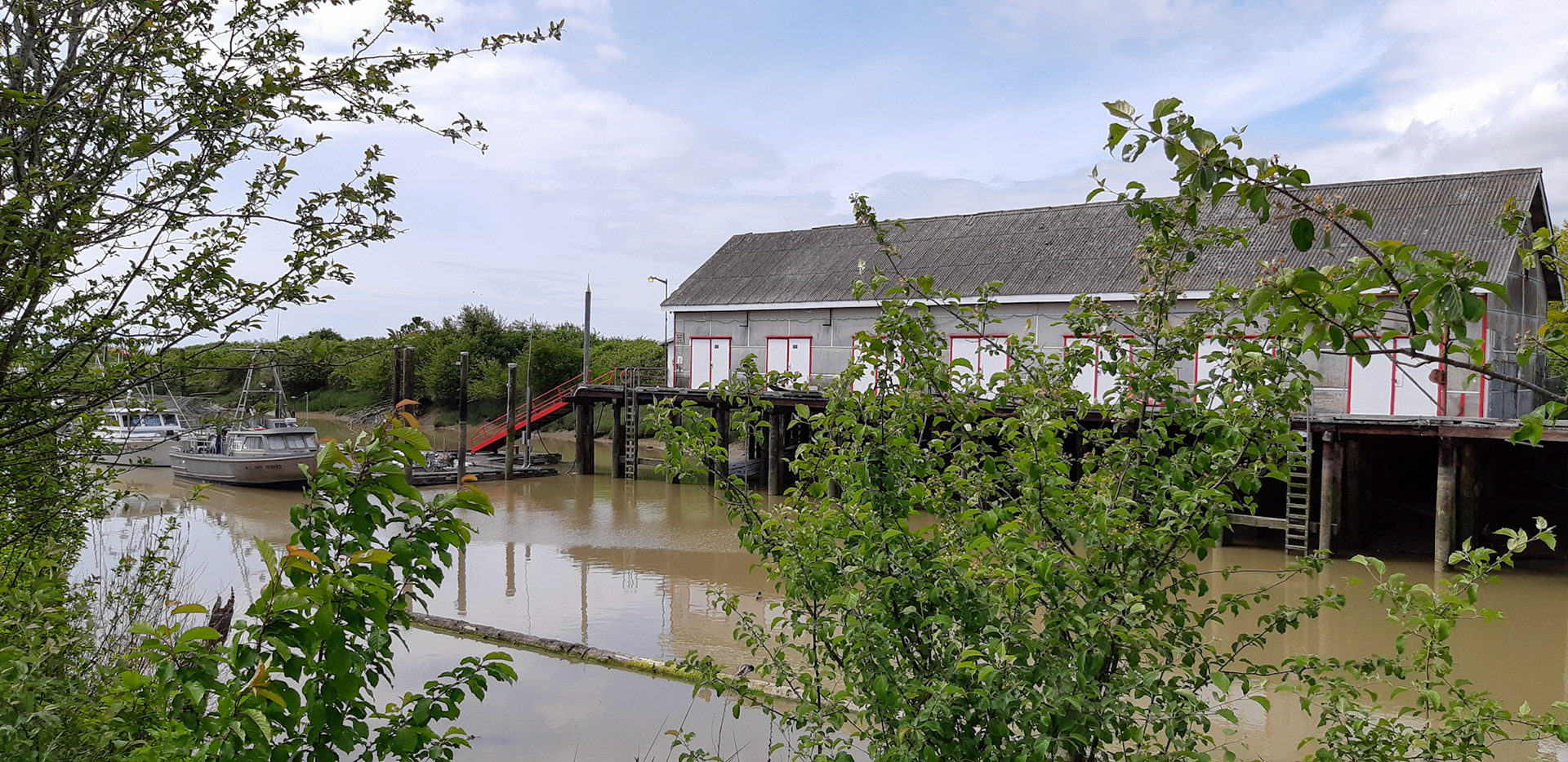
Scotch Pond - Steveston, Richmond, British Columbia
Scotch Pond - Steveston, Richmond, British Columbia

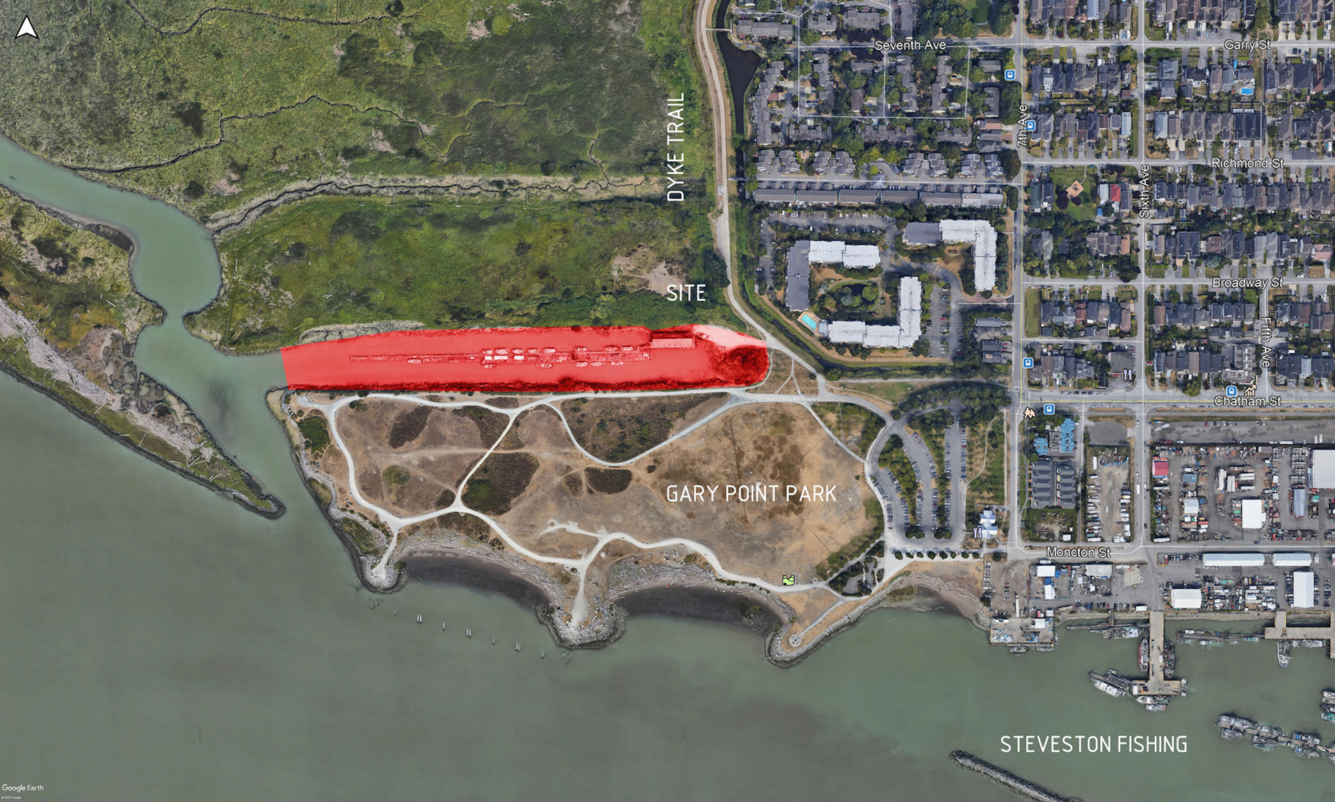
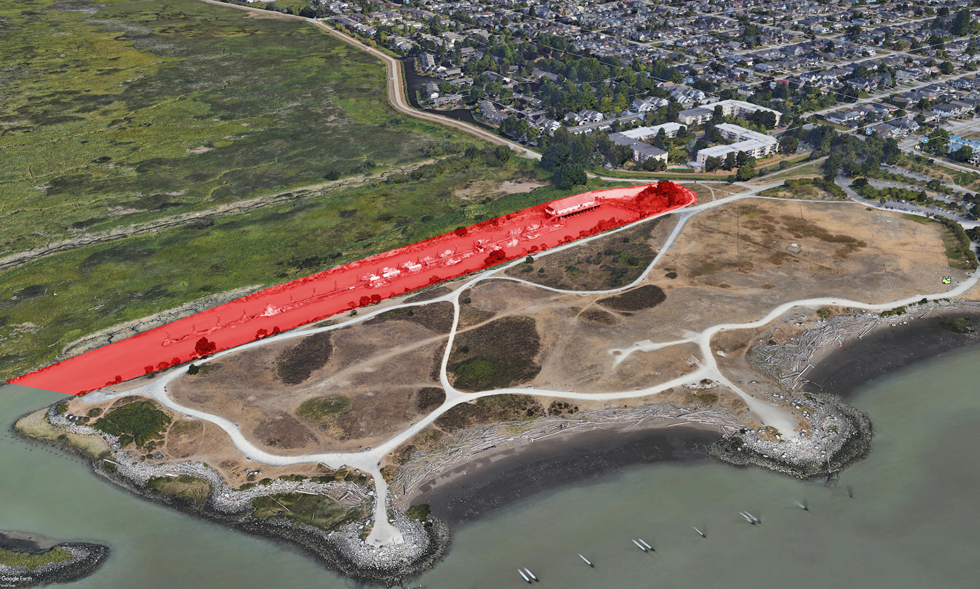


Description of Site
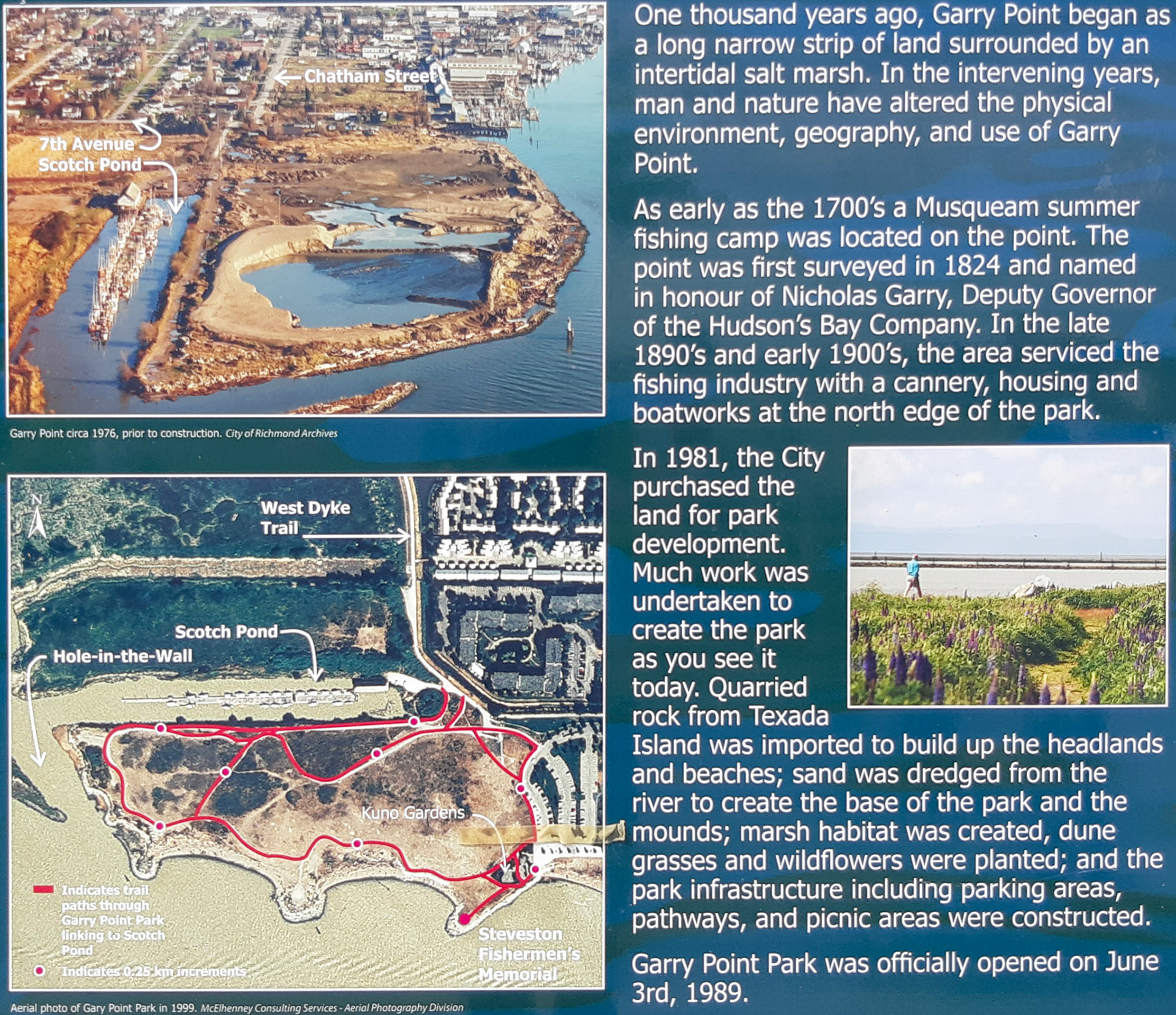
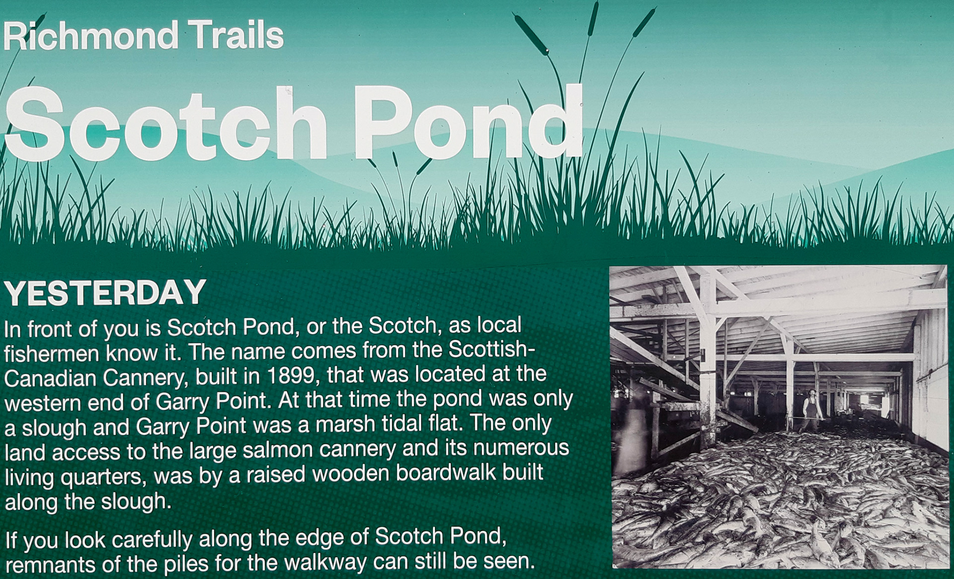
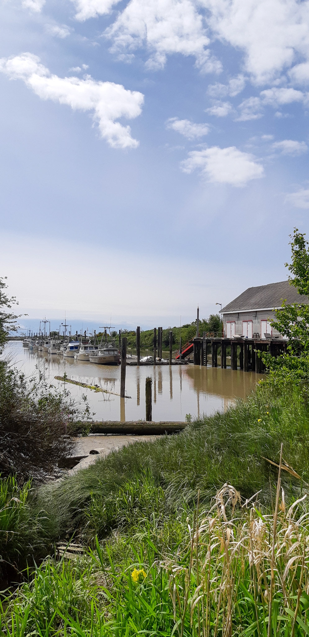
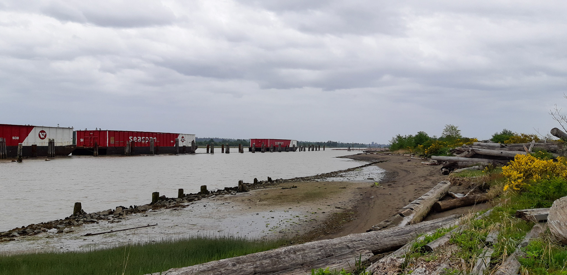
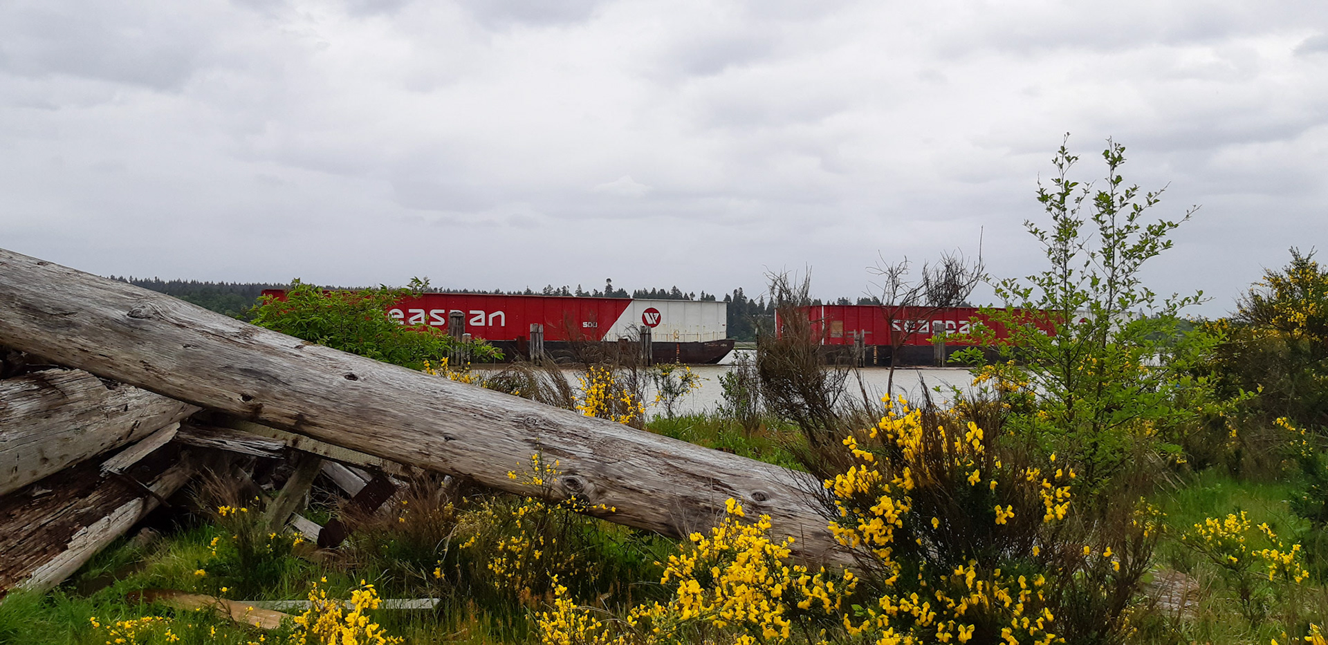
Originally a slough, dredged in the early 1950s and connected by a channel to the Strait of Georgia. Remains of wooden boardwalk pilings along the south edge were constructed in 1899 as part of the Scottish Canadian Cannery operation. The site is designated heritage.
Originally a slough, dredged in the early 1950s and connected by a channel to the Strait of Georgia. Remains of wooden boardwalk pilings along the south edge were constructed in 1899 as part of the Scottish Canadian Cannery operation. The site is designated heritage.
Statement of Values
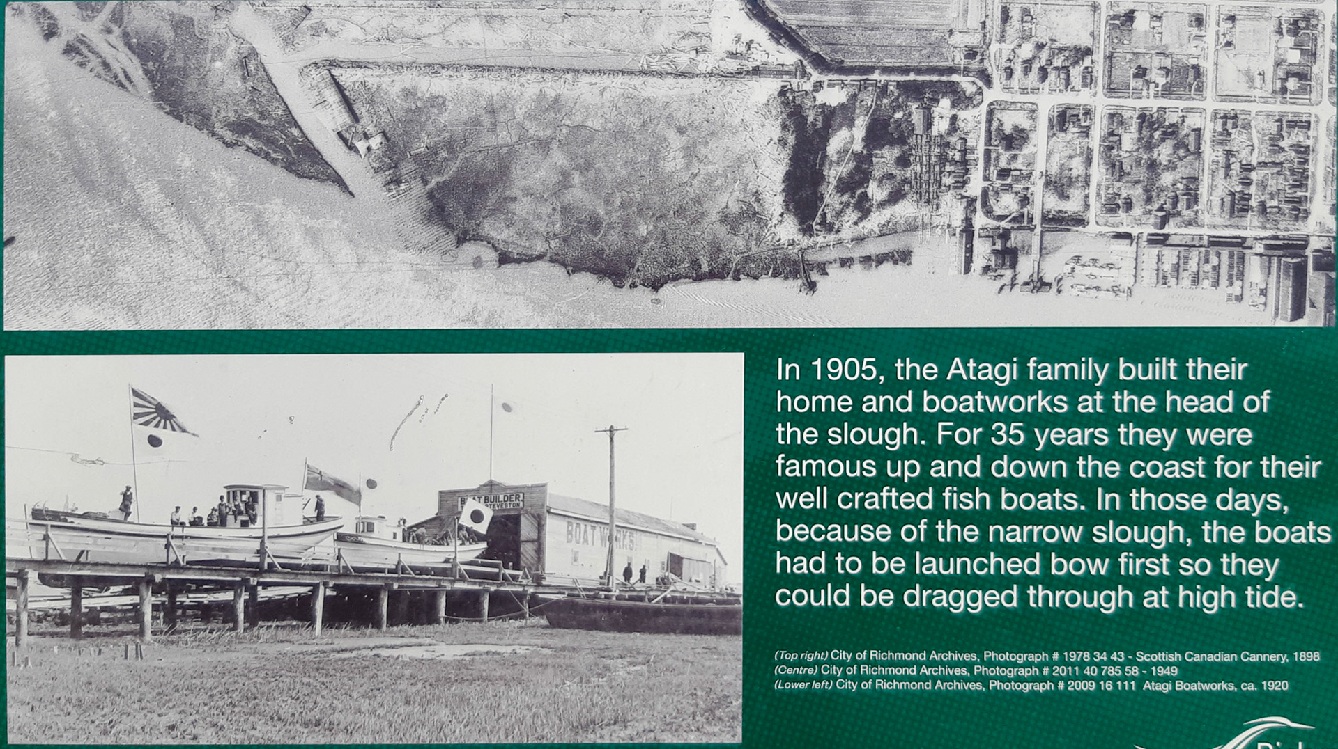
The original slough at Garry Point was the location of a year round Musqueam Indian settlement until the late 1890’s, with the Scottish Canadian Cannery built by Malcolm and Windsor in 1899, with the Atagi Boatworks located at the head of the slough and operated until Japanese internment during World War II, and finally with the dredging operation undertaken in the 1950’s by the Canadian Fishing Company.
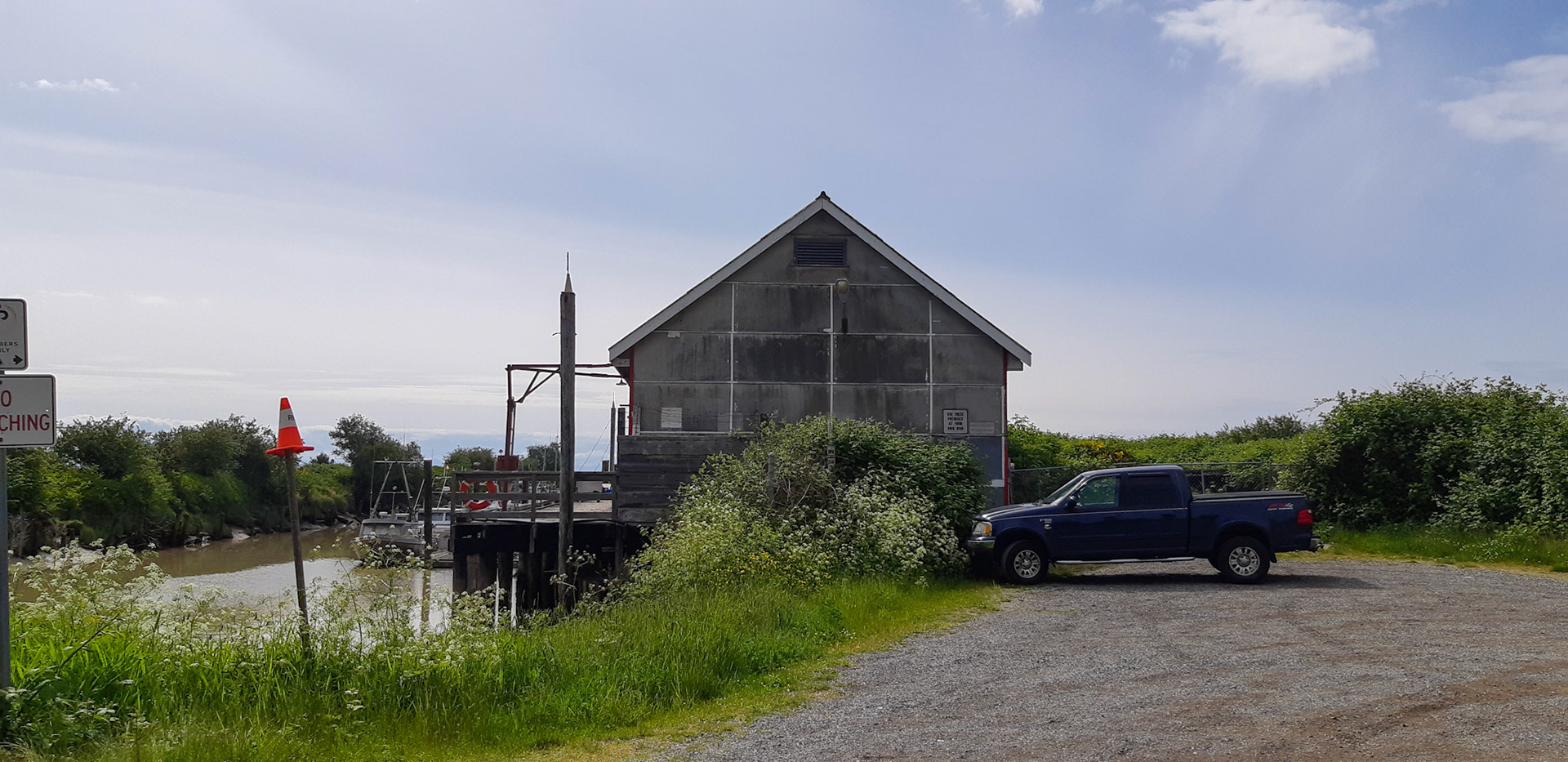
Scotch Pond has value as an early and rare example of an industrial development and small community built away from the shoreline within an area of tidal flats, constructed entirely on wooden pilings, its only connection to the land a narrow wooden boardwalk.
The original slough at Garry Point was the location of a year round Musqueam Indian settlement until the late 1890’s, with the Scottish Canadian Cannery built by Malcolm and Windsor in 1899, with the Atagi Boatworks located at the head of the slough and operated until Japanese internment during World War II, and finally with the dredging operation undertaken in the 1950’s by the Canadian Fishing Company.
Scotch Pond has value as an early and rare example of an industrial development and small community built away from the shoreline within an area of tidal flats, constructed entirely on wooden pilings, its only connection to the land a narrow wooden boardwalk.
Character Defining Elements
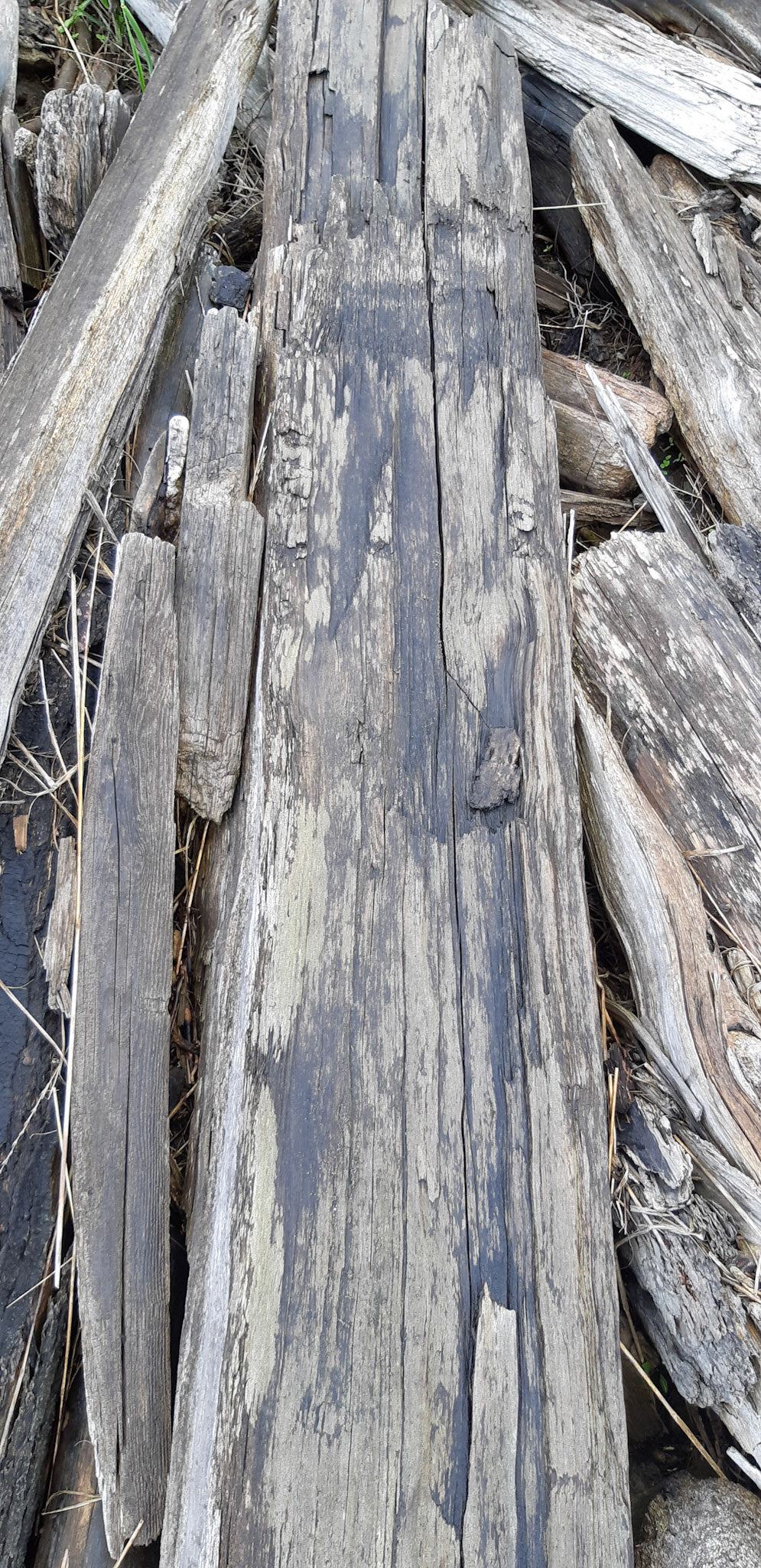
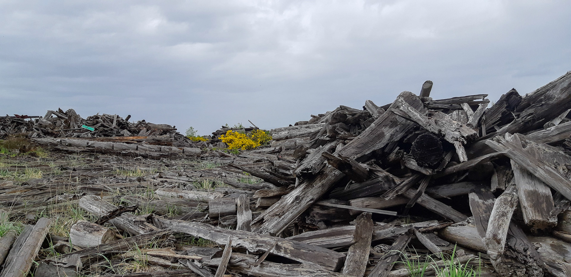
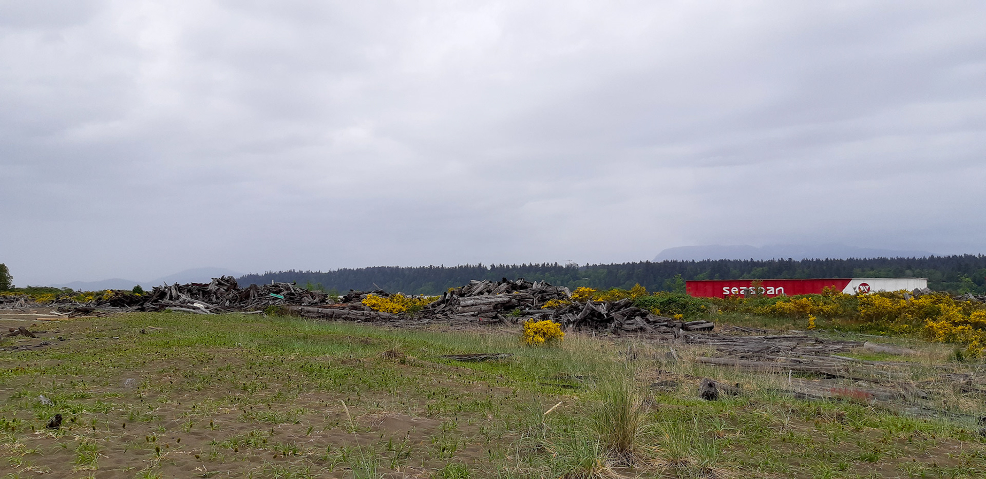
Wooden pilings along the south edge which are the remains of the original connecting boardwalk from the Scottish Canadian Cannery to Steveston.
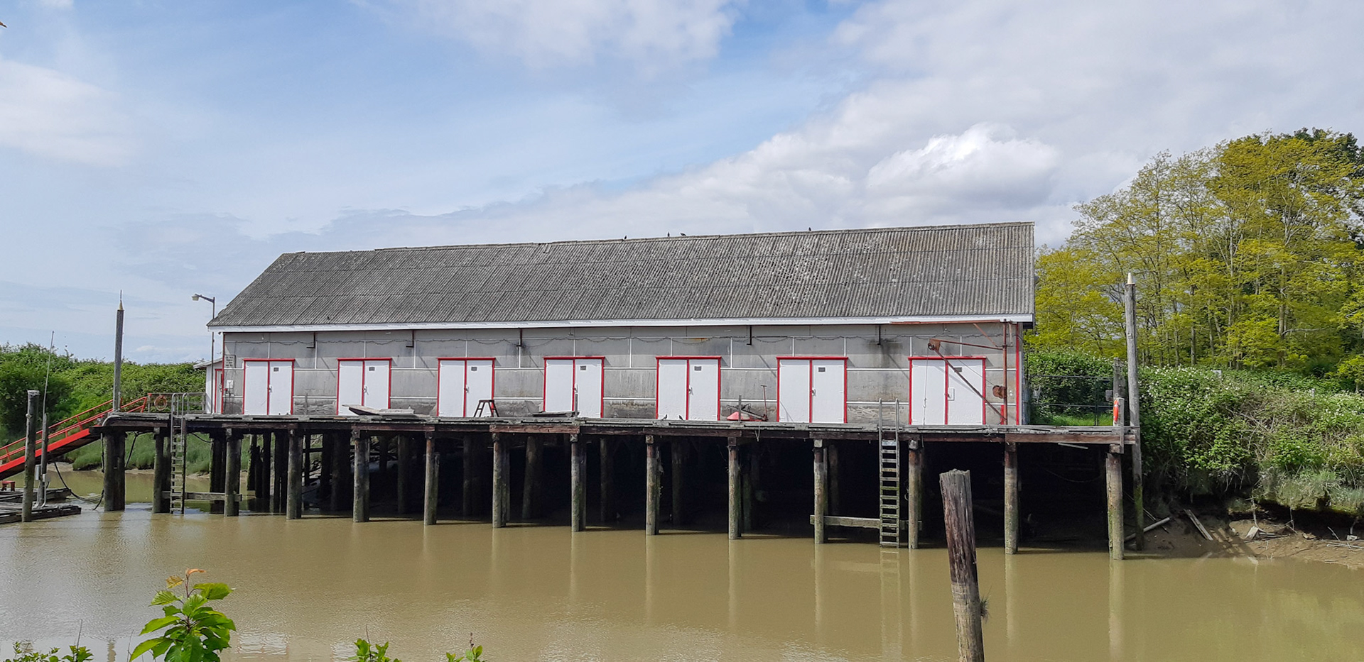
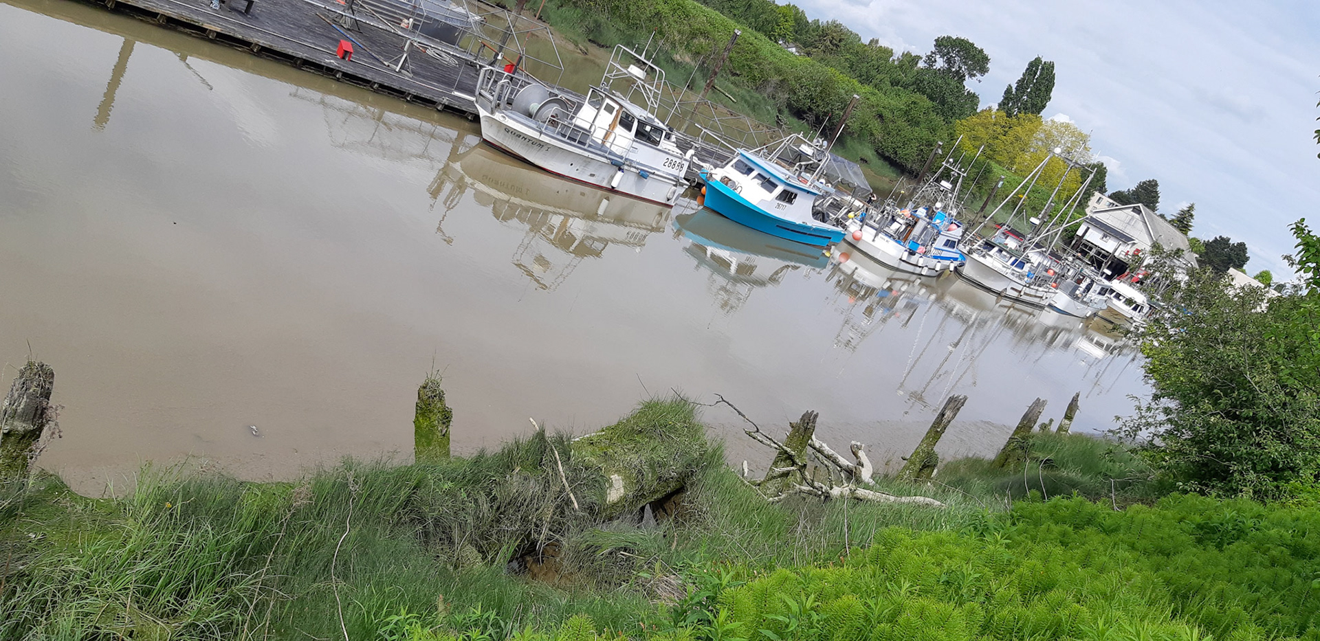
Currently used by the fishing industry through the Scotch Pond Heritage Co-operative.
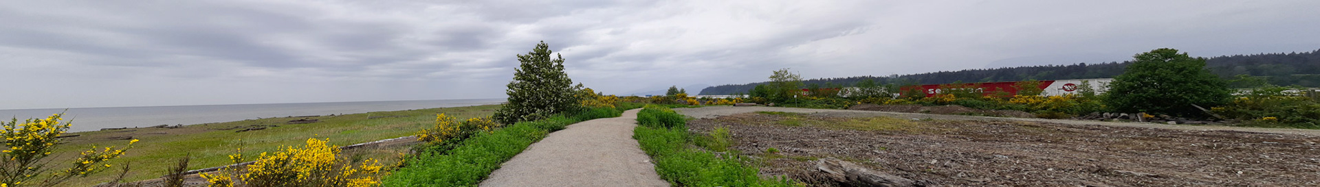
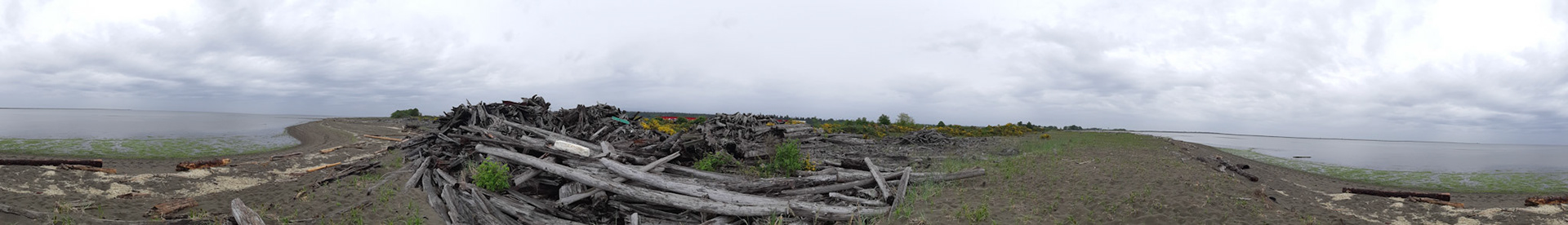
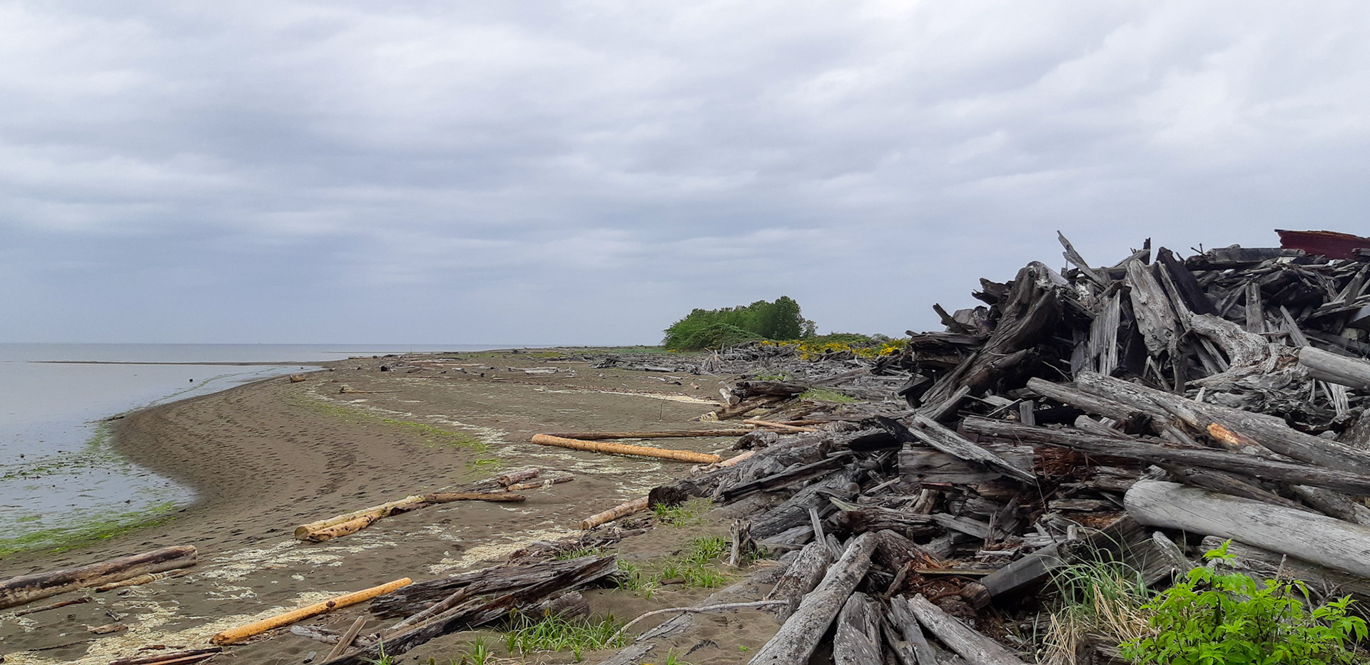
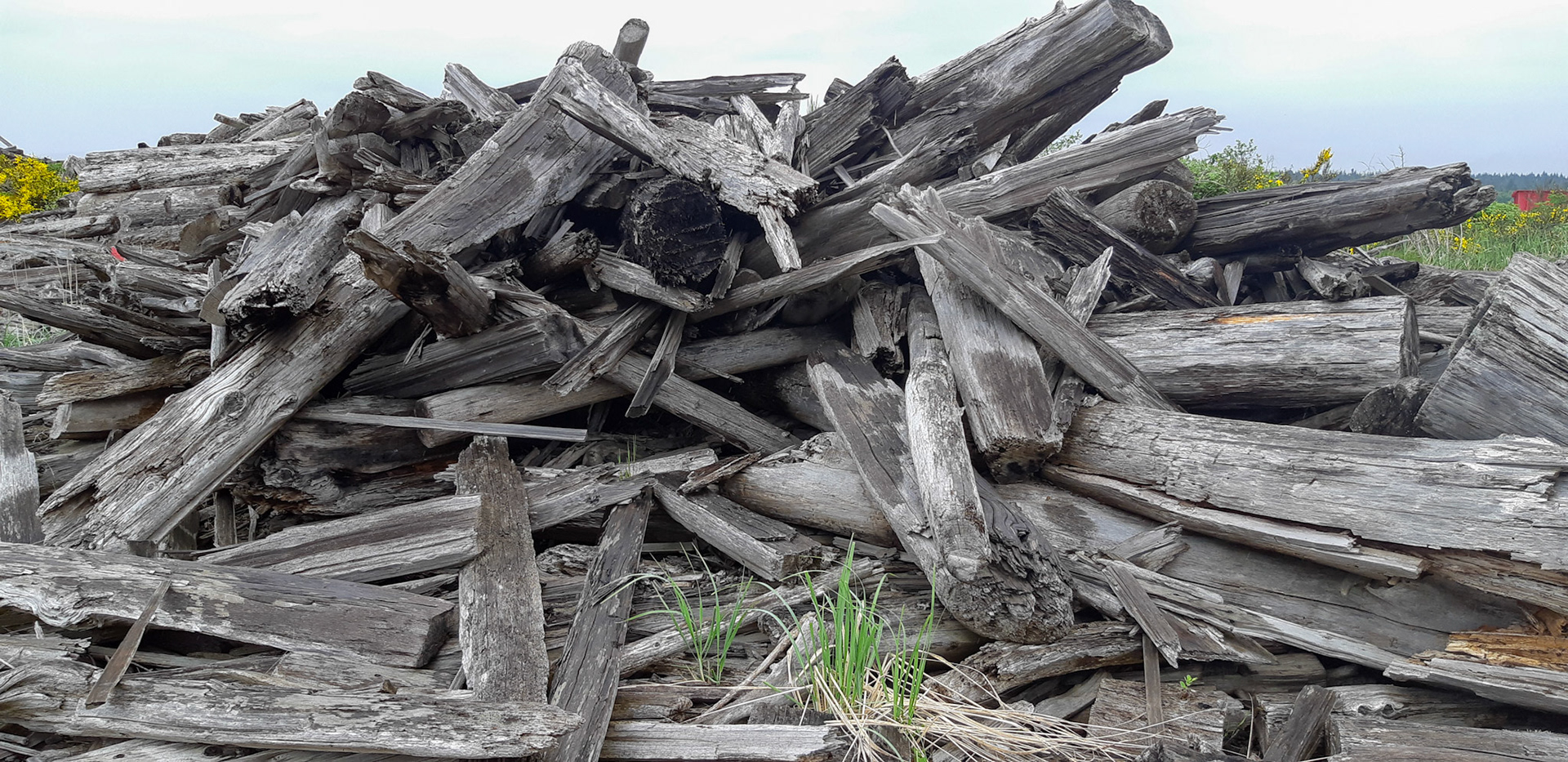
Sturgeon Banks tidal flats as a context for this heritage feature.
Wooden pilings along the south edge which are the remains of the original connecting boardwalk from the Scottish Canadian Cannery to Steveston.
Currently used by the fishing industry through the Scotch Pond Heritage Co-operative.
Sturgeon Banks tidal flats as a context for this heritage feature.
Design Attributes
The cannery itself was constructed on an angle to take advantage of another slough channel which provided river access and moorage for fishing boats. When Scotch Pond was created, it followed these original natural and built patterns, using the original Scottish Canadian ‘pond’ as access into the larger, dredged ‘Scotch Pond’. Today these features are evidence of the interaction of people with the land for a purpose, and visually represent two layers: the subtle layer of the original pilings of the boardwalk, and the subsequent construction and use of Scotch Pond.
The cannery itself was constructed on an angle to take advantage of another slough channel which provided river access and moorage for fishing boats. When Scotch Pond was created, it followed these original natural and built patterns, using the original Scottish Canadian ‘pond’ as access into the larger, dredged ‘Scotch Pond’. Today these features are evidence of the interaction of people with the land for a purpose, and visually represent two layers: the subtle layer of the original pilings of the boardwalk, and the subsequent construction and use of Scotch Pond.
Alterations
Except for the boardwalk remnants, the Scottish Canadian Cannery has disappeared. The boardwalk pilings have been almost completely demolished, and exist merely as clues in the landscape. Scotch Pond as constructed in the 1950’s is still an important part of the landscape today, but the original slough that was the ‘pond’ for the cannery is no longer visible.
Except for the boardwalk remnants, the Scottish Canadian Cannery has disappeared. The boardwalk pilings have been almost completely demolished, and exist merely as clues in the landscape. Scotch Pond as constructed in the 1950’s is still an important part of the landscape today, but the original slough that was the ‘pond’ for the cannery is no longer visible.
Condition
The pilings and boardwalk remnants are in poor condition compared to the original. They are not obvious, yet when noticed they still manage to convey a sense of what existed there in the past.
The pilings and boardwalk remnants are in poor condition compared to the original. They are not obvious, yet when noticed they still manage to convey a sense of what existed there in the past.
Site B
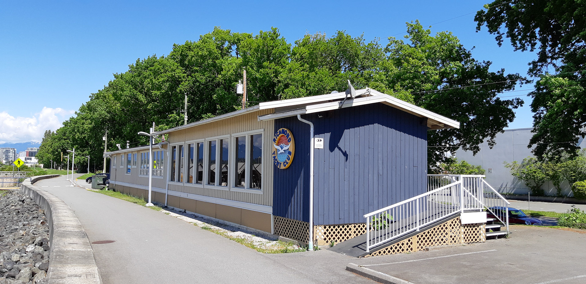
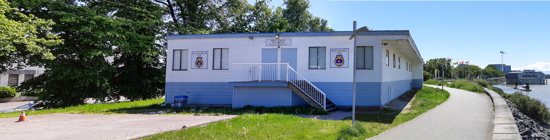
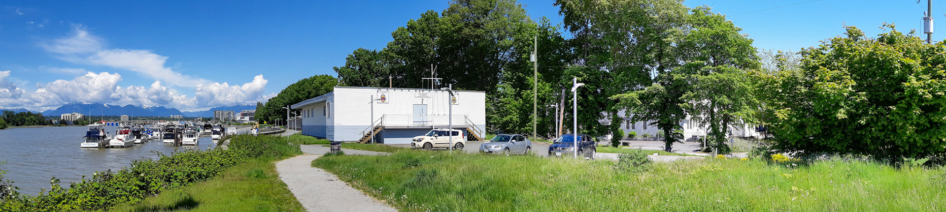
Navy League + Richmond Yatch Club, Richmond, British Columbia
Navy League + Richmond Yatch Club, Richmond, British Columbia


Description of Site
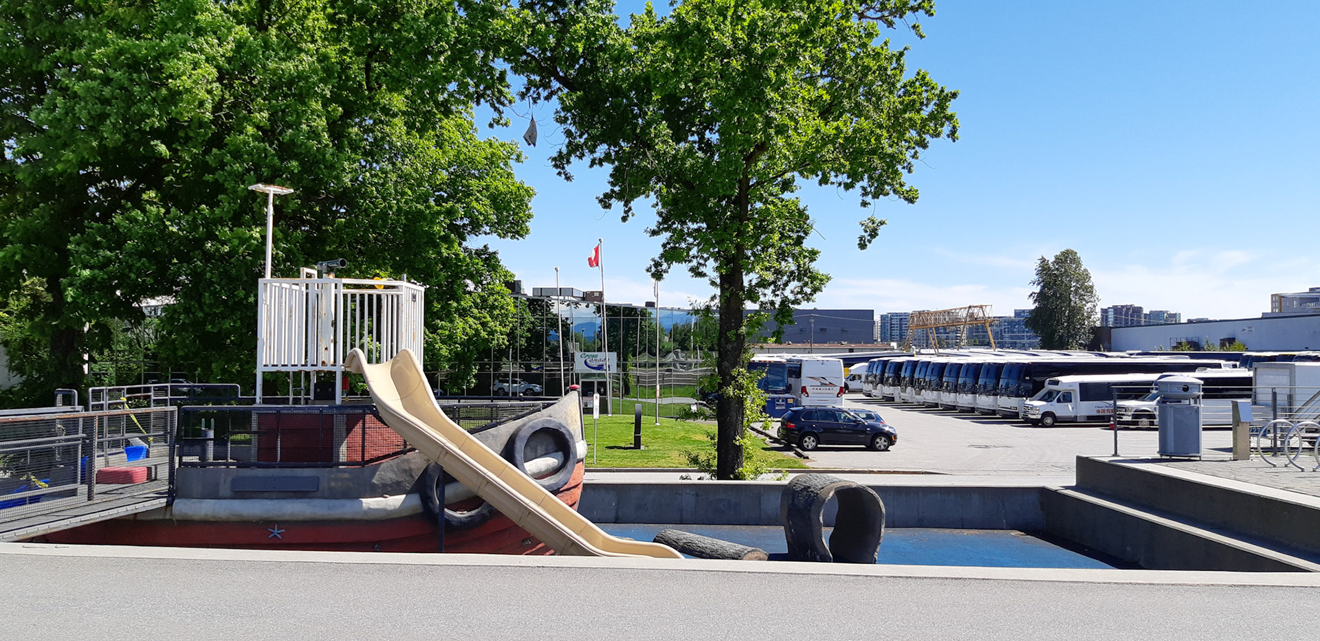
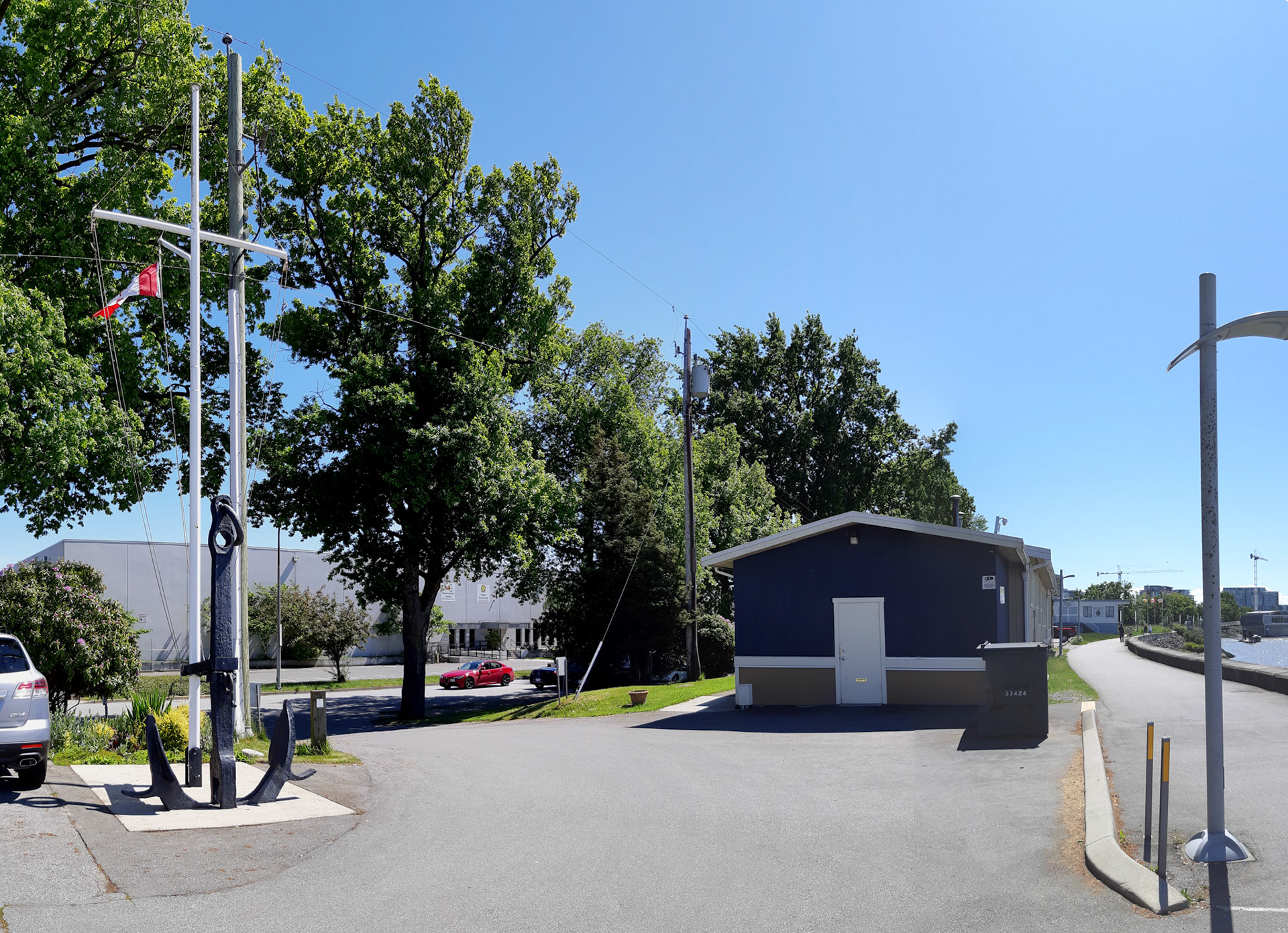
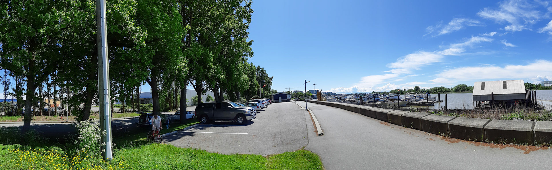
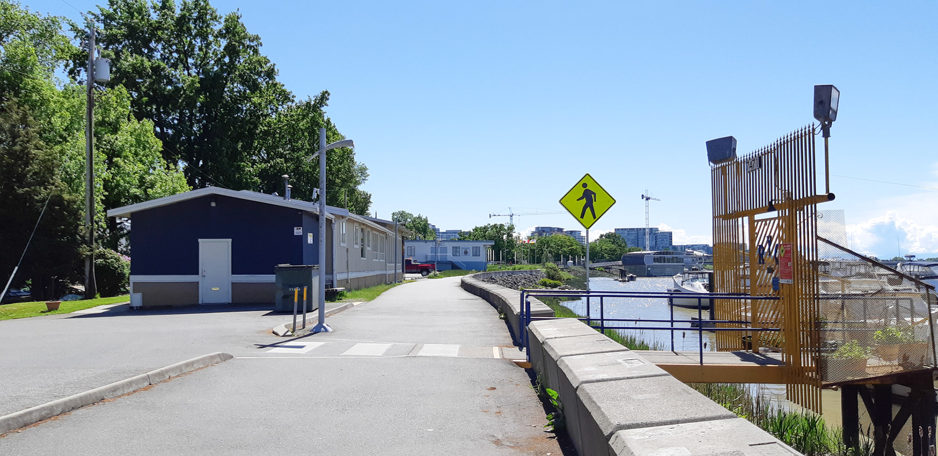
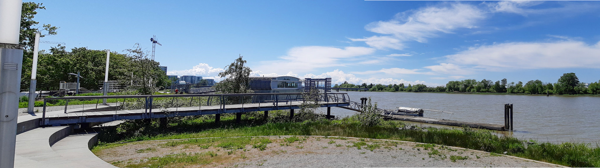
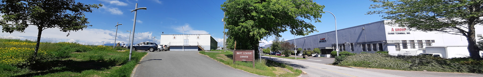
The Navy League Building and Richmond Yacht Club occupies the crest of the dyke trail north of the UBC Boathouse, and consists various landscaping features and pedestrian access. The Navy League Building and Richmond Yacht Club are examples of 1960s marine-themed architecture, with the UBC Boathouse the newest addition representative modern 2000s west-coast architecture.
The Navy League Building and Richmond Yacht Club occupies the crest of the dyke trail north of the UBC Boathouse, and consists various landscaping features and pedestrian access. The Navy League Building and Richmond Yacht Club are examples of 1960s marine-themed architecture, with the UBC Boathouse the newest addition representative modern 2000s west-coast architecture.
Statement of Values
Pending additional research.
Pending additional research.
Character Defining Elements
Key elements that define the character of the site include:
The Navy League Building, Richmond Yacht Club, and UBC Boathouse.
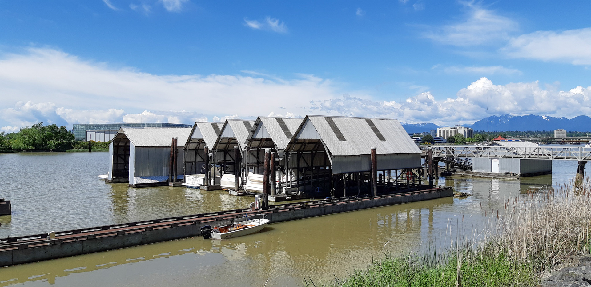
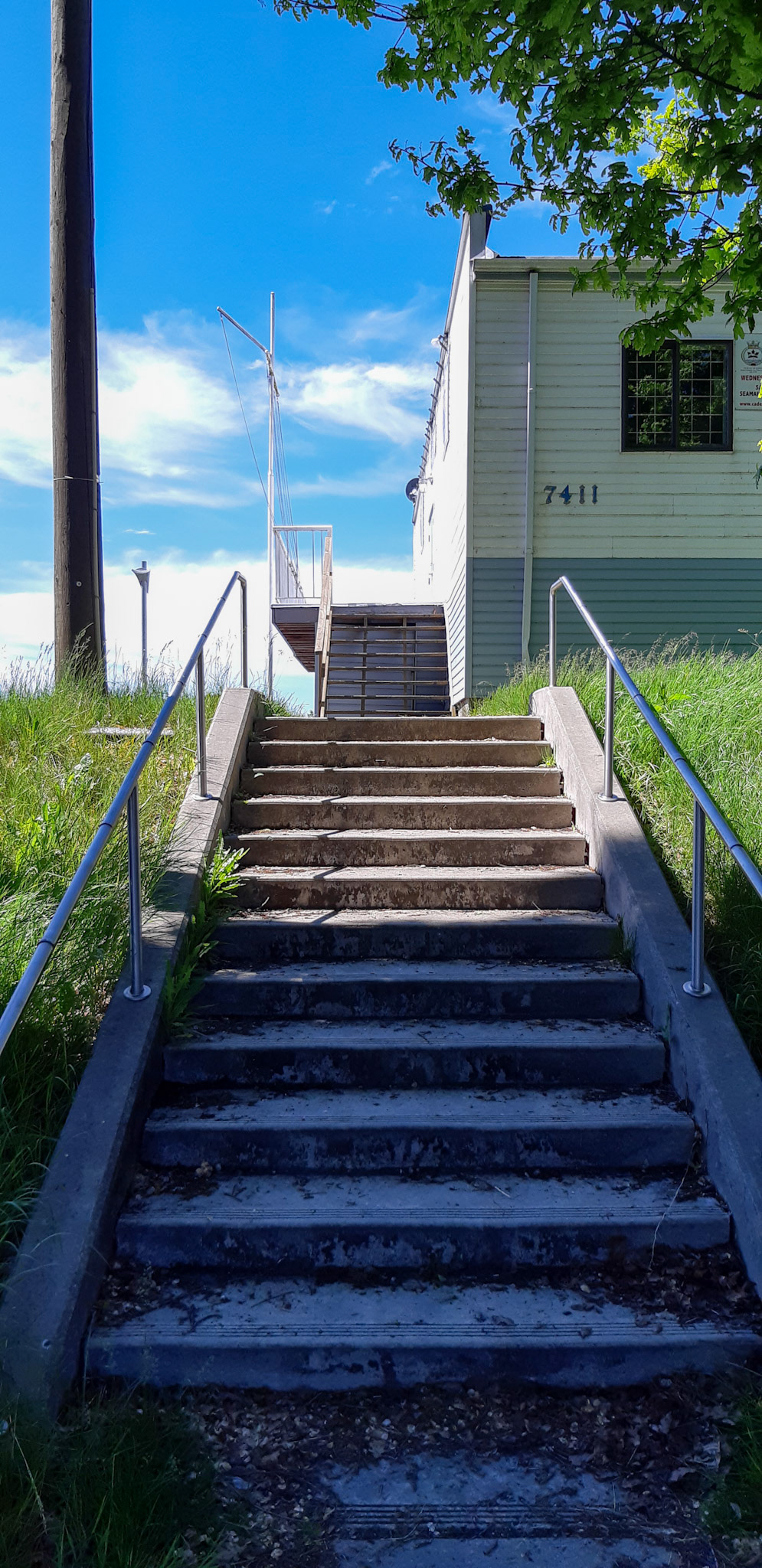
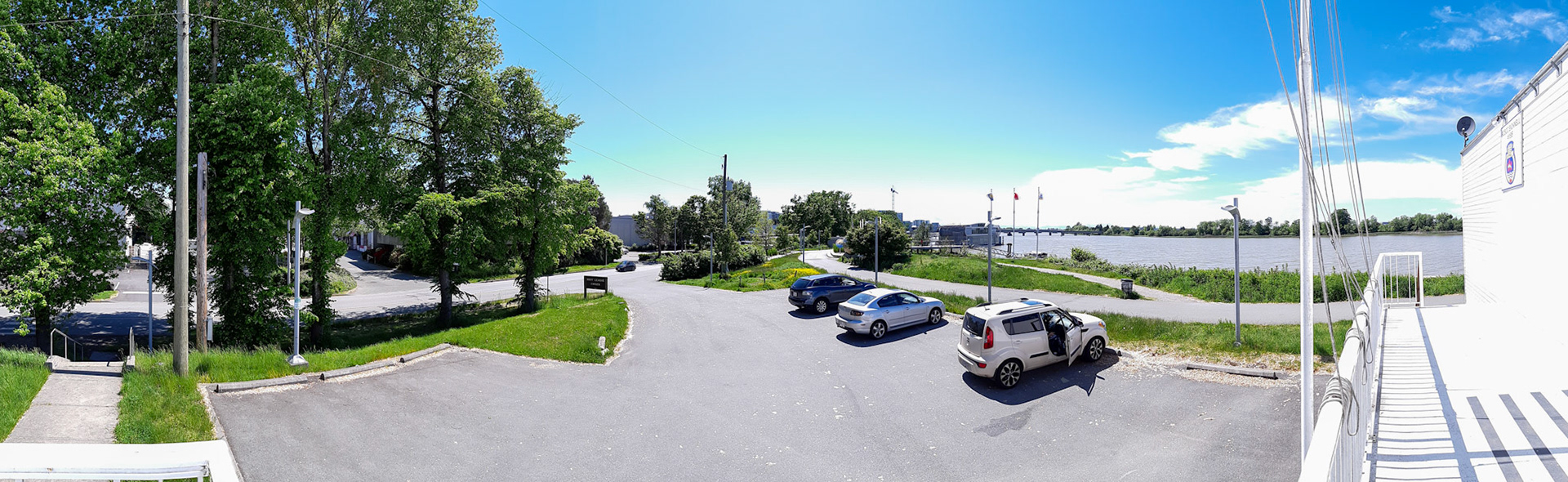
Landscape features including a dragon-boat staging area, docks, outdoor amphitheater, playground structures, pedestrian trials and crossings, and automotive parking.
Proximity to the Fraser River and industrial zoning in Richmond.
Key elements that define the character of the site include:
The Navy League Building, Richmond Yacht Club, and UBC Boathouse.
Landscape features including a dragon-boat staging area, docks, outdoor amphitheater, playground structures, pedestrian trials and crossings, and automotive parking.
Proximity to the Fraser River and industrial zoning in Richmond.
Architectural Significance
Architectural Style
1960s Marine, 2000s Modern
Architectural Style
1960s Marine, 2000s Modern
Alterations
The landscape features were mainly developed for the 2010 Winter Olympic games, with the dyke being the primary means of access from the Canada Line Aberdeen Station to the Olympic Oval. The Navy League Building has been relatively unaltered: repairs and maintenance where necessary, and the naval gun being moved in the development of the parking lot. The Richmond Yacht Club has also remained relatively unaltered.
The landscape features were mainly developed for the 2010 Winter Olympic games, with the dyke being the primary means of access from the Canada Line Aberdeen Station to the Olympic Oval. The Navy League Building has been relatively unaltered: repairs and maintenance where necessary, and the naval gun being moved in the development of the parking lot. The Richmond Yacht Club has also remained relatively unaltered.
Condition
Varying conditions.
Varying conditions.
Site C
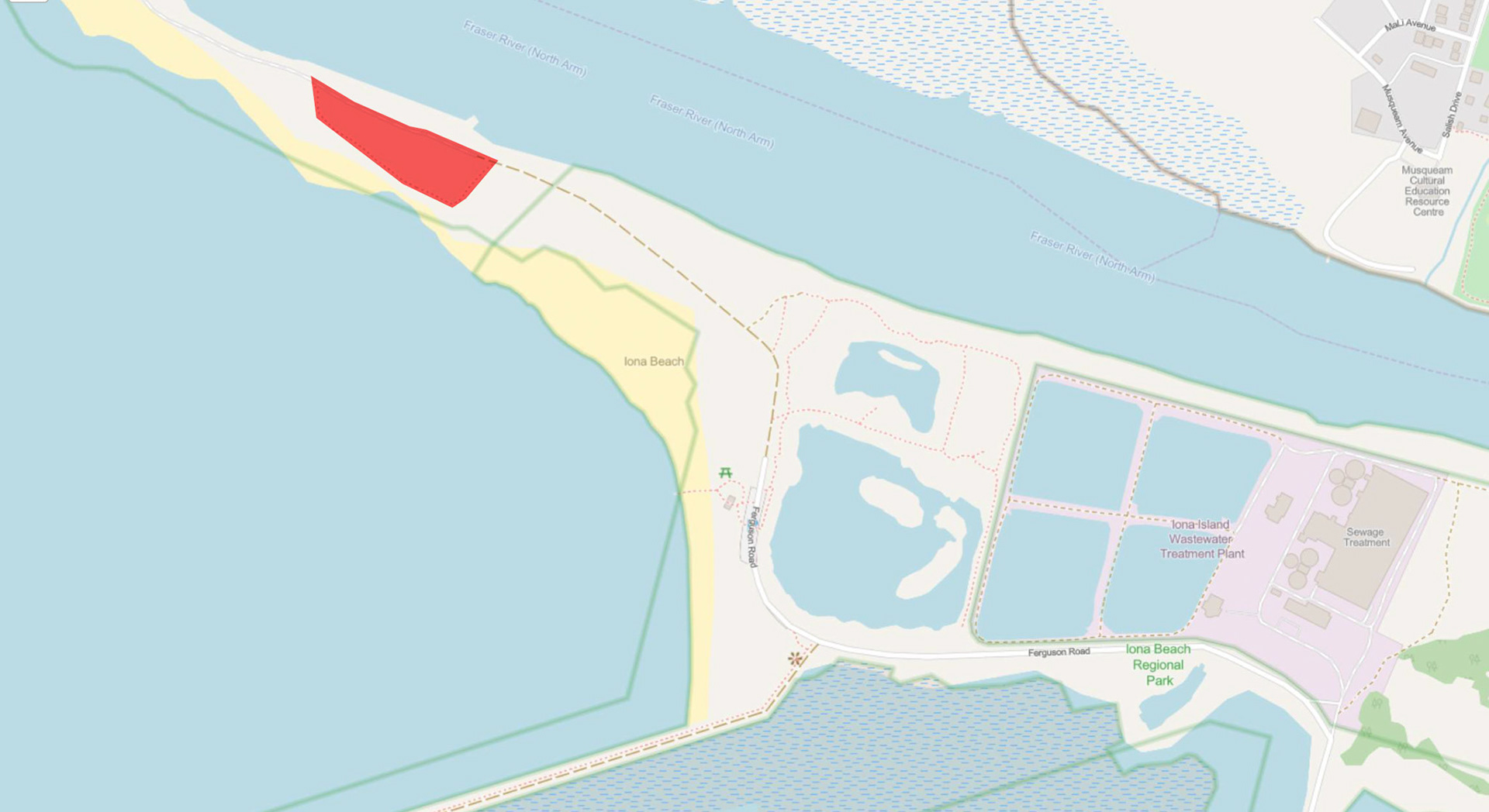
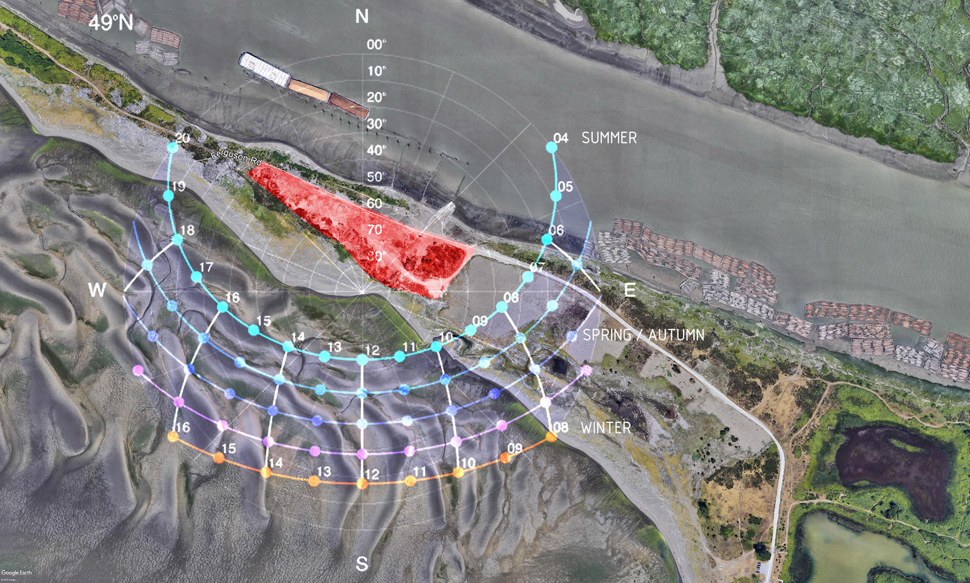
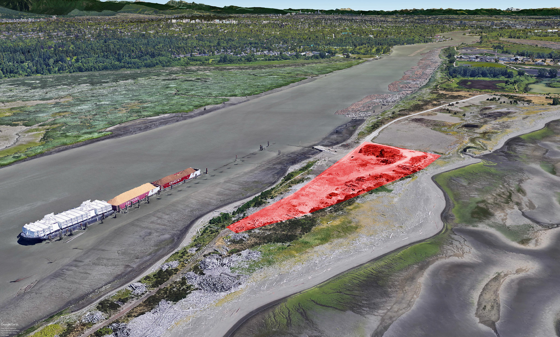
VFPA Fibre Recovery Zone - Iona Beach, Richmond, British Columbia
VFPA Fibre Recovery Zone - Iona Beach, Richmond, British Columbia


https://www.richmond.ca/plandev/planning2/heritage/HeritageInv/details.aspx?ID=32
Description of Site
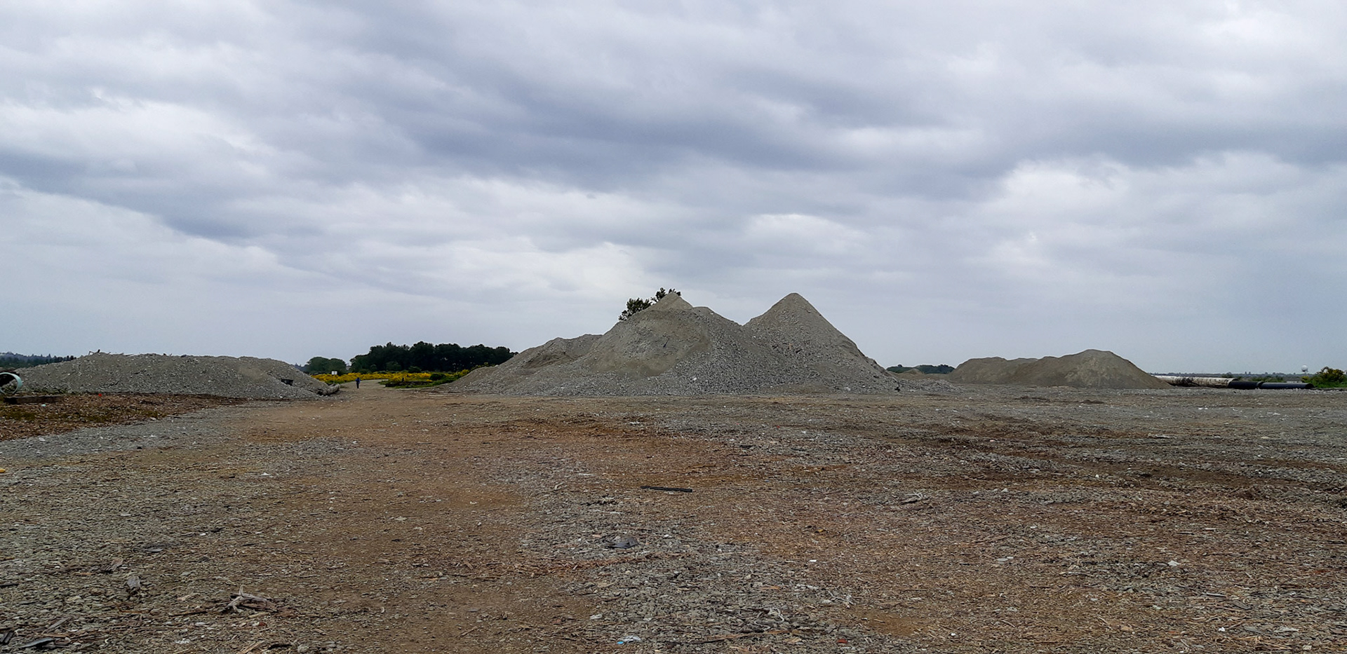
Iona Beach is arrived at from a noticeable 2-lane drive from the Vancouver Airport terminal. The approach is like a procession, and although located within the heart between Vancouver and Richmond, large swaths of nature create a buffer between the park and metropolitan areas.
Iona Beach is arrived at from a noticeable 2-lane drive from the Vancouver Airport terminal. The approach is like a procession, and although located within the heart between Vancouver and Richmond, large swaths of nature create a buffer between the park and metropolitan areas.
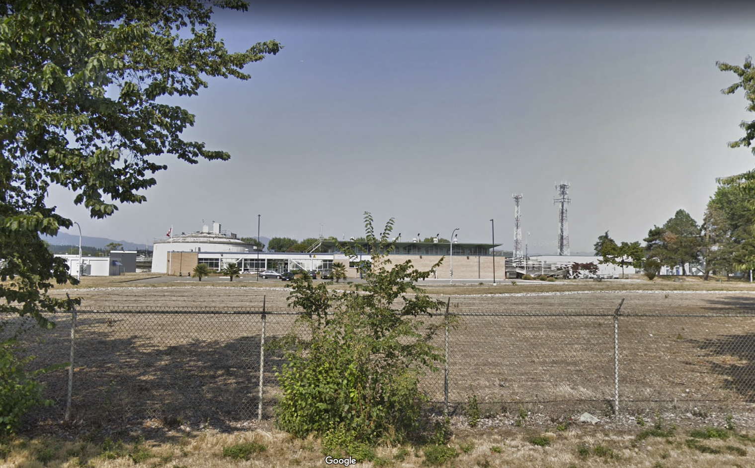
The Greater Vancouver Sewage Treatment Plant occupies most of Iona Island, and consists of a complex of administrative buildings, sludge lagoons, digesters, wastewater treatment plant and a composting site located at the end of a long driveway. The primary administration and power building is concrete and modern, with horizontal massing and large areas of glazing. The north-eastern edge of the island is dedicated to a regional park and marshland. The site is not designated heritage, but is within the heritage inventory.
Statement of Values
The Iona Wastewater Treatment Plant has historical significance as it represents the emergence of Richmond’s importance as a member of the Greater Vancouver Regional District. Scientific value is illustrated by the plant in the early awareness of the issues of environmental protection.
Aesthetically, the Treatment Plant is an important heritage resource as a local representation of the industrial architectural style of the 1960s. The administration and power building is a good example of 1960s modernism, and the building exhibits a graceful and powerful built form.
Character Defining Elements
Key elements that define the heritage character of the site include:
The power and administration building is an example of 1960’s modernism.
15 pre-aeration and sedimentation tanks arranged in a grid.
Location on Iona Island and access by causeway from Sea Island.
Symbolism as part of early environmental awareness of the 1960’s.
Presence of the regional park nearby.
Architectural Significance
Architectural Style
Modern
Industrial
Architectural Style
Modern
Industrial
Name of Architect or Builder
Brown and Caldwell Civil Engineers, San Francisco, California, and
Cripper Wright Engineering Ltd, Vancouver, BC.
Brown and Caldwell Civil Engineers, San Francisco, California, and
Cripper Wright Engineering Ltd, Vancouver, BC.
Design Features
The administration portion is faced with brick and has a flat roof.
The front entryway is centred and accessed by concrete steps and a partially enclosed porch. Reflective glazing symmetrically flanks either side of the porch, and on each side is a steel cross-brace placed on the exterior and set at an angle.
The power portion of the building is the most striking.
Although the bulk of the building is a simple box-shape faced with brick, the upper portion has an elegant clerestory with peaked windows which allow natural lighting into the power room below.
The roof is an unusual triangular design with a vaulted ceiling.
Although the bulk of the building is a simple box-shape faced with brick, the upper portion has an elegant clerestory with peaked windows which allow natural lighting into the power room below.
The roof is an unusual triangular design with a vaulted ceiling.
The four digesters and the preaeration and sedimentation tanks are visually imposing structures.
The digesters are very large and circular, looking more like fat grain silos than treatment tanks.
The preaeration and sedimentation tanks are located in a large, open-air structure.
These tanks number 15 in all and are lined up in a grid pattern.
Netting is being placed above this structure to keep the birds away.
Alterations
The Plant has undergone six phases over the last forty years. These are:
Phase 1: April 1963. Construction of the plant
(Power and Administration building, Preaeration and Sedimentation Tanks #1 - 5, Digesters #1 & 2, Sludge Thickener, Pump Building and Grit Chambers).
Phase 2: January 1972. Construction of Preaeration and Sedimentation Tanks # 6 - 10.
Phase 3: August 1978. Construction of Digesters # 3 & 4 and Sludge Thickener # 2.
Phase 4: September 1981. Construction of Preaeration and Sedimentation Tanks # 11 - 13.
Phase 5: November 1985. Construction of Preaeration and Sedimentation Tanks # 14 & 15.
Phase 6: September 1986. Construction of new, deep sea outfall and Effluent Pump Station.
All of the above phases mark the addition of buildings and equipment to the Plant and not physical alterations to existing buildings. The Plant is currently undergoing an upgrading of its monitoring and control system. The original 1960’s pump control and overall monitoring boards are being replaced with state of the art computer systems. As well, new engines replaced the original ones in 1998. Also in the power building, an insulating window has been added as a second layer between the control room and the power floor to create both a sound and climate barrier between the two areas. At present, the original roofs of digesters # 1 and 2 are being replaced with new.
The Sewage Treatment Plant is currently undergoing design for improved capacity and clarification, as well as planned changes to the entirety of the surrounding landscape for environmental improvement and sustainability.
Condition
Very good condition.
Very good condition.
Choosing a Site
Site A: Scotch Pond - Steveston, Richmond, British Columbia
Site B: Navy League + Richmond Yatch Club, Richmond, British Columbia
Site C: VFPA Fibre Recovery Zone - Iona Beach, Richmond, British Columbia
Site A: Scotch Pond - Steveston, Richmond, British Columbia
Site B: Navy League + Richmond Yatch Club, Richmond, British Columbia
Site C: VFPA Fibre Recovery Zone - Iona Beach, Richmond, British Columbia
Distinctive Sites
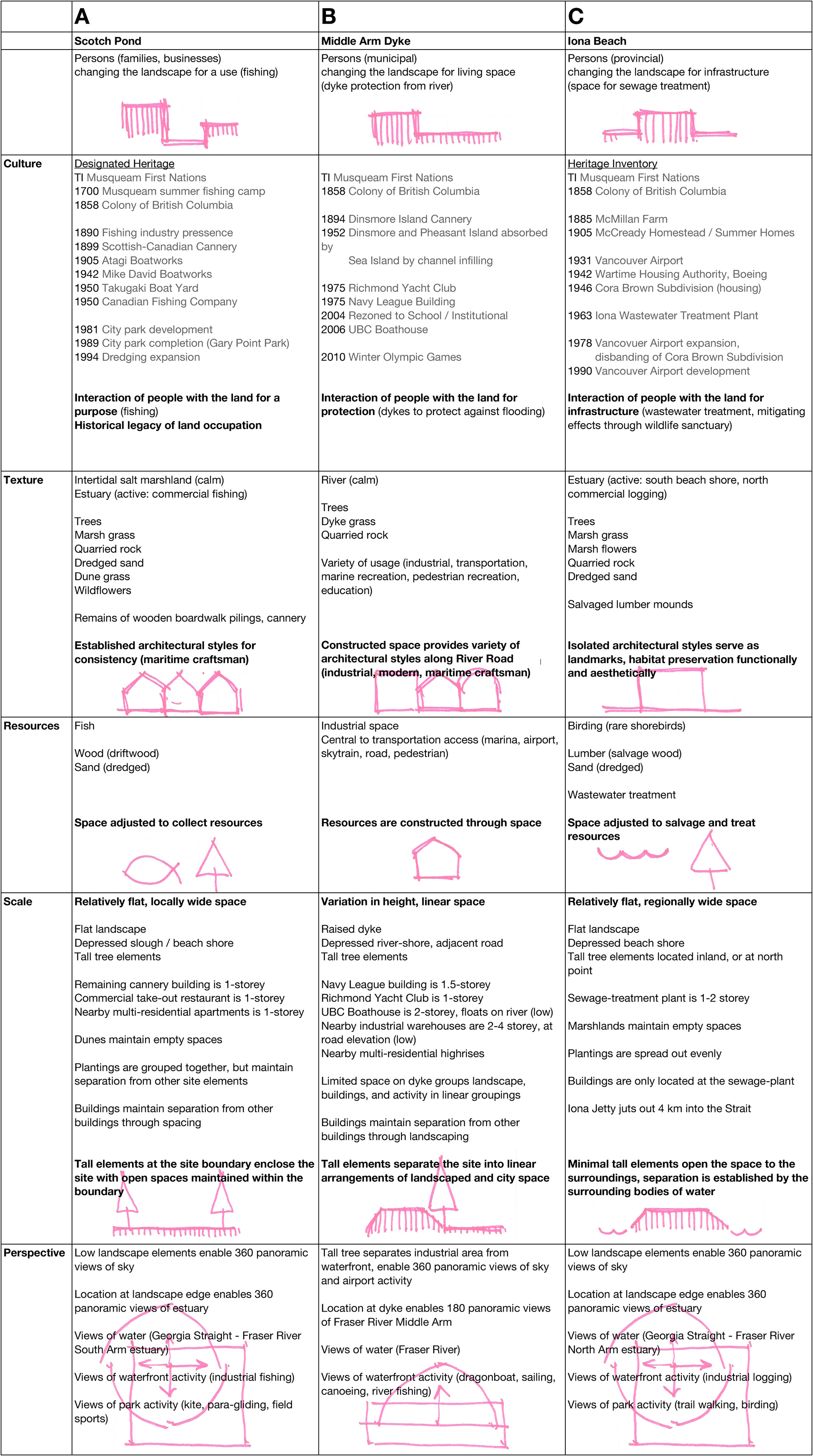
Culture... representative of history - geological, social, economic, or political change.
Texture... diversity in physical and social texture, harmony developed through difference
Resources... distinctive resources fostering a vernacular aesthetic
Scale... a variety of large / small, tall / large, single / plural; to provide a comparative relationship.
Perspective... enables focal points from different locations, physical and introspective.
Site A
Scotch Pond - Steveston, Richmond, British Columbia
Culture... representative of history - geological, social, economic, or political change.
Legacy of different persons interacting with the land for a specific use enables future design to examine how to interpret this use through different perspectives.
Legacy of different persons interacting with the land for a specific use enables future design to examine how to interpret this use through different perspectives.
Texture... diversity in physical and social texture, harmony developed through difference
An established architectural style enables future design to conform or contrast in material, function, and form.
An established architectural style enables future design to conform or contrast in material, function, and form.
Resources... distinctive resources fostering a vernacular aesthetic
Nearby resources are of the habitat, and establish a dialogue with the history of the site.
Nearby resources are of the habitat, and establish a dialogue with the history of the site.
Scale... a variety of large / small, tall / large, single / plural; to provide a comparative relationship.
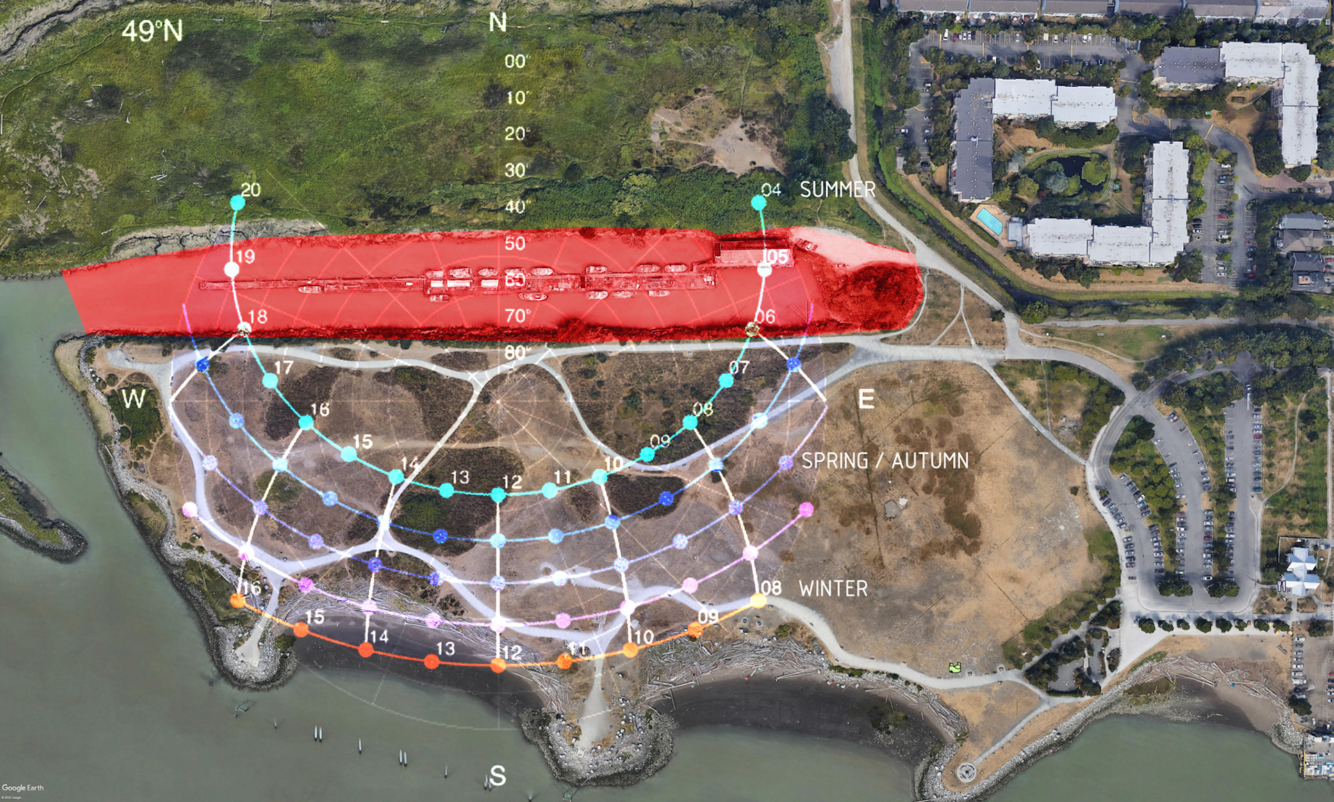
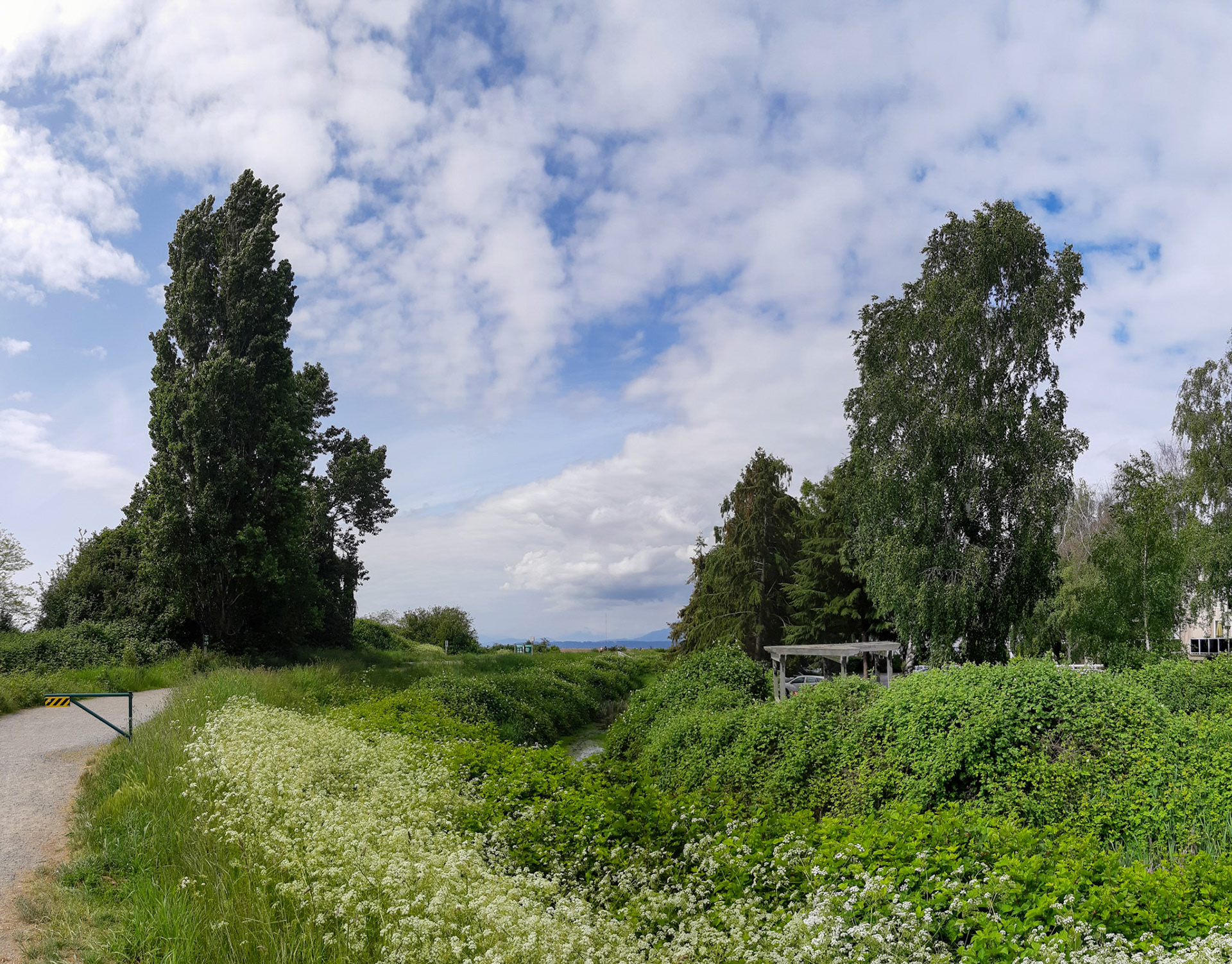
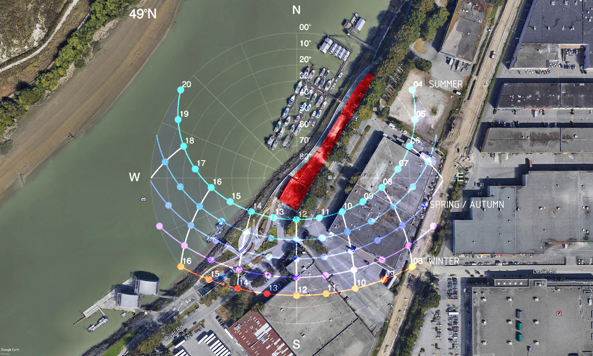
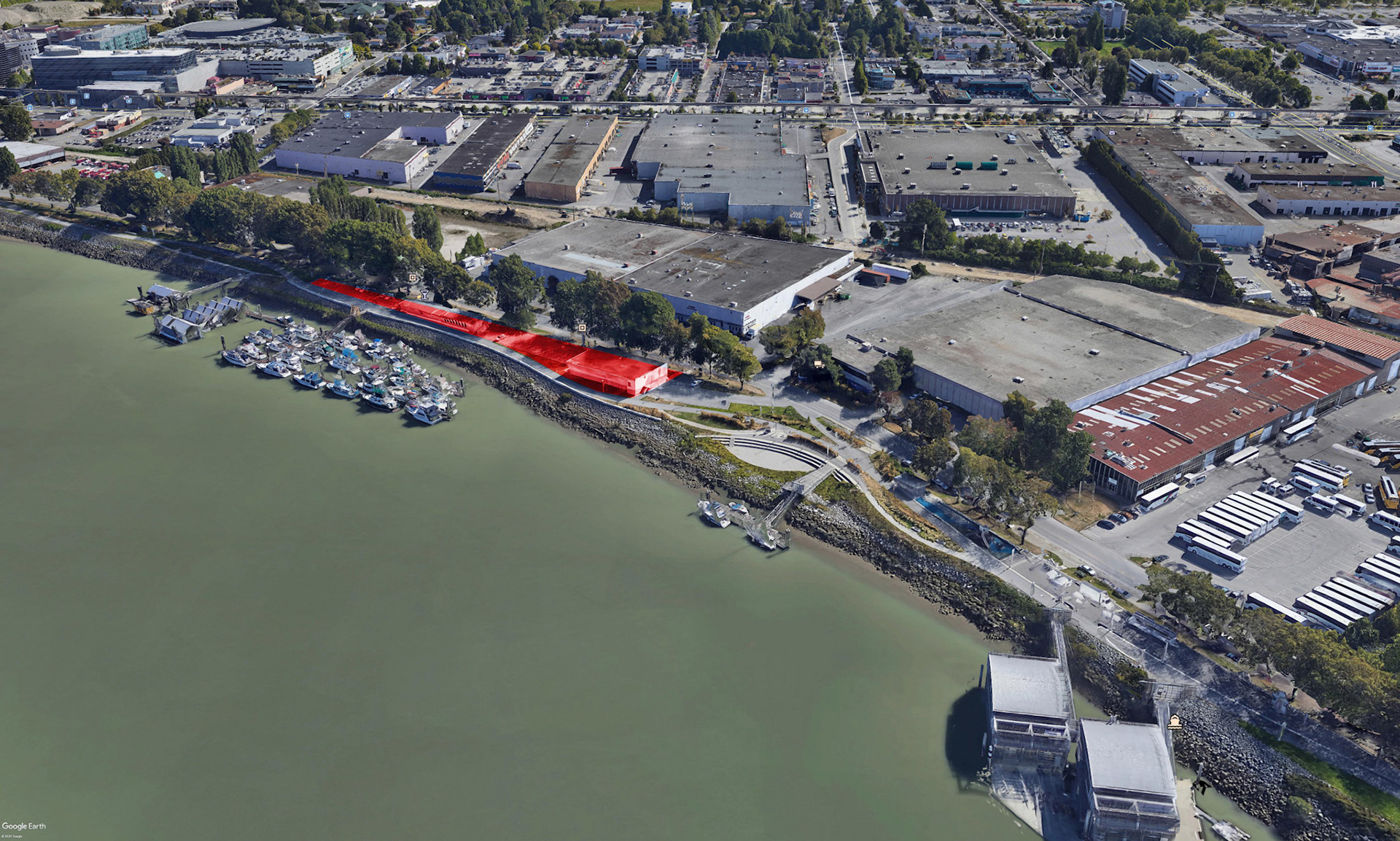
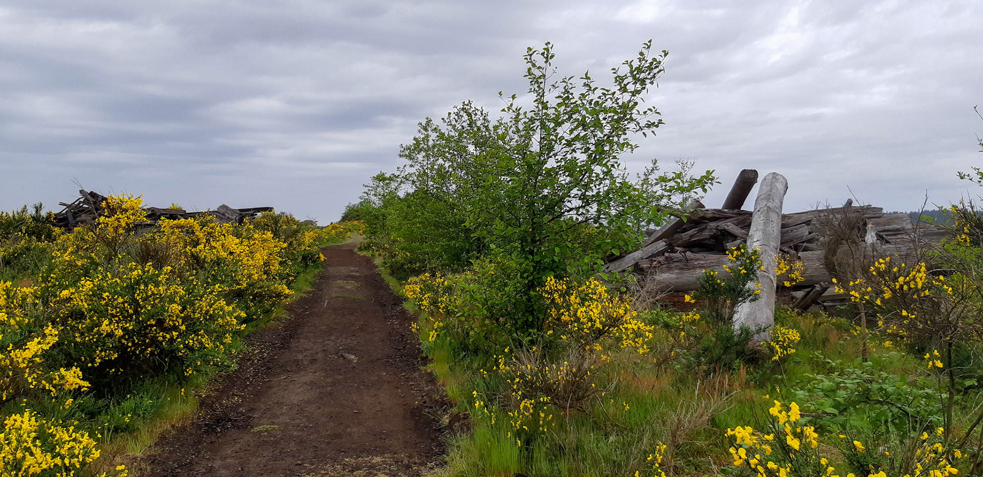
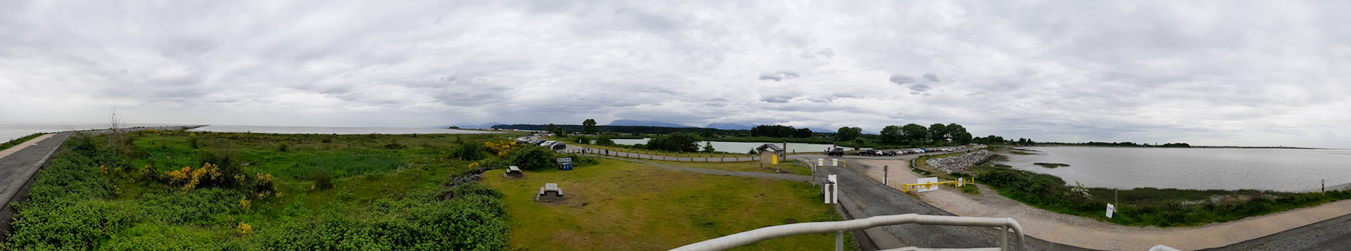
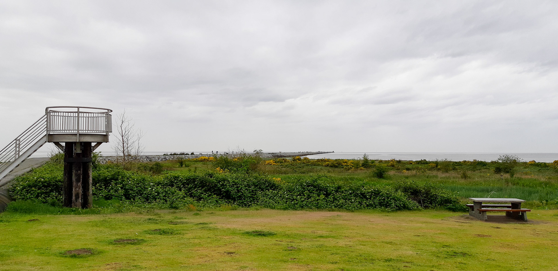
Scale within scale is demonstrated as Scotch Pond is within Garry Point Park within Lulu Island (Richmond) within the Greater Vancouver Region. While the park is relatively flat, the pond enables dynamic scales with rising / falling tides.
Scale within scale is demonstrated as Scotch Pond is within Garry Point Park within Lulu Island (Richmond) within the Greater Vancouver Region. While the park is relatively flat, the pond enables dynamic scales with rising / falling tides.
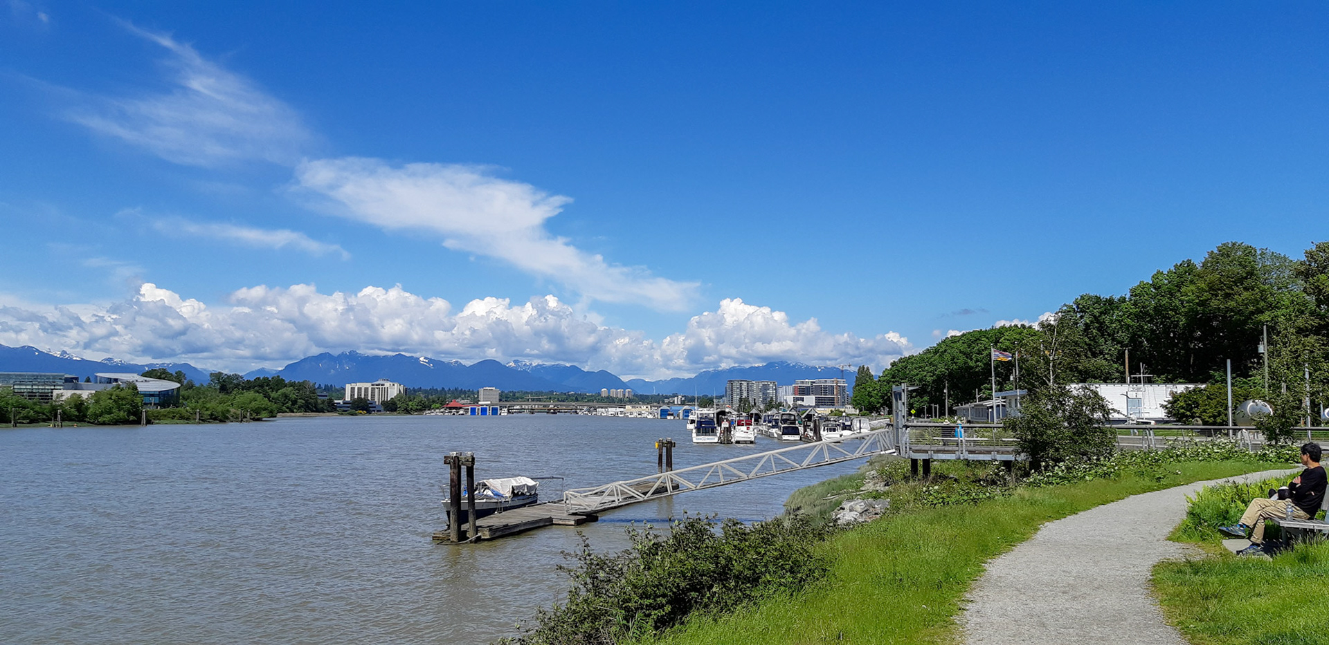
Perspective... enables focal points from different locations, physical and introspective.
Little obstruction with some vertical elements enable views to be framed, variety of activities provide intersection opportunities.
Little obstruction with some vertical elements enable views to be framed, variety of activities provide intersection opportunities.
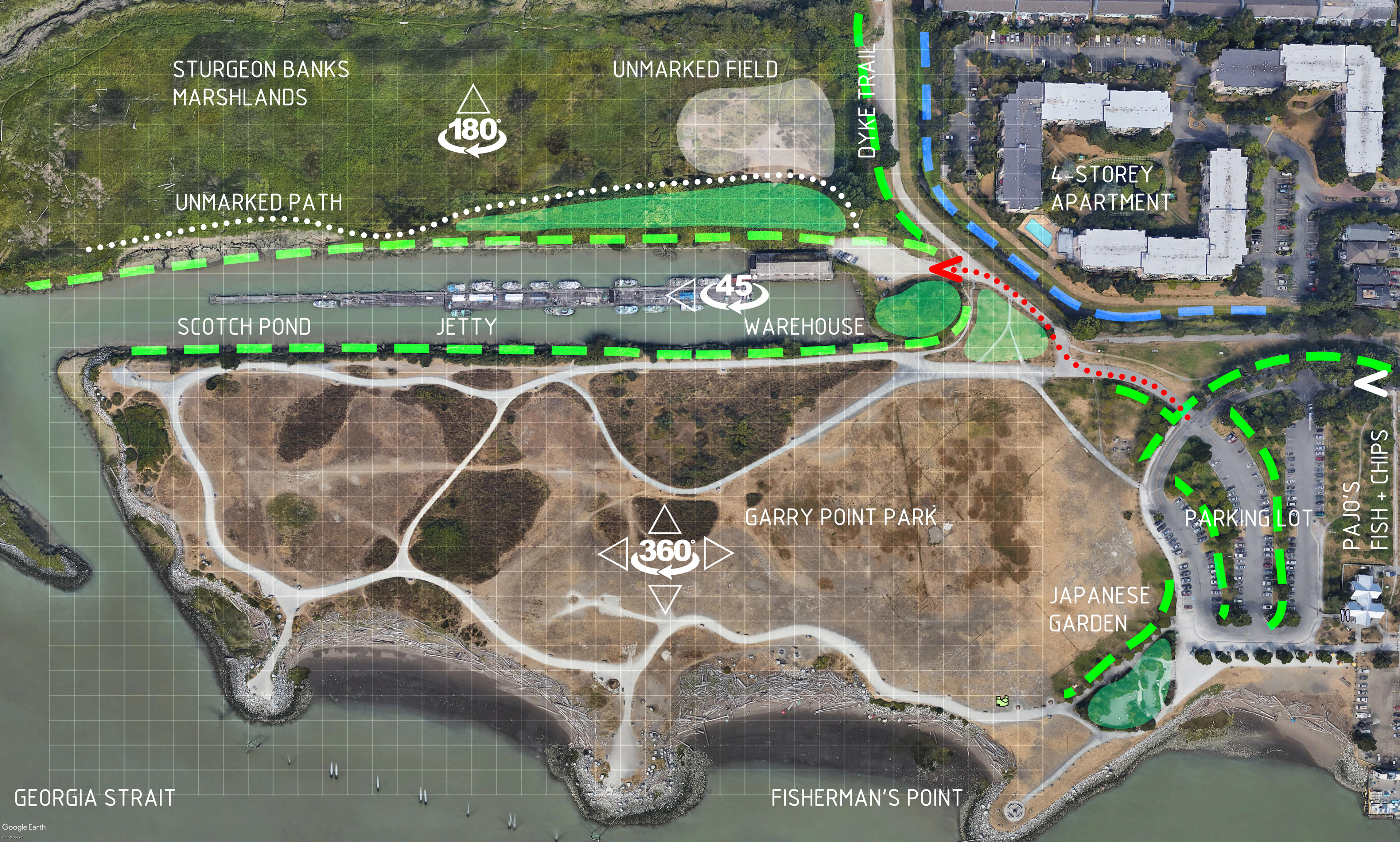
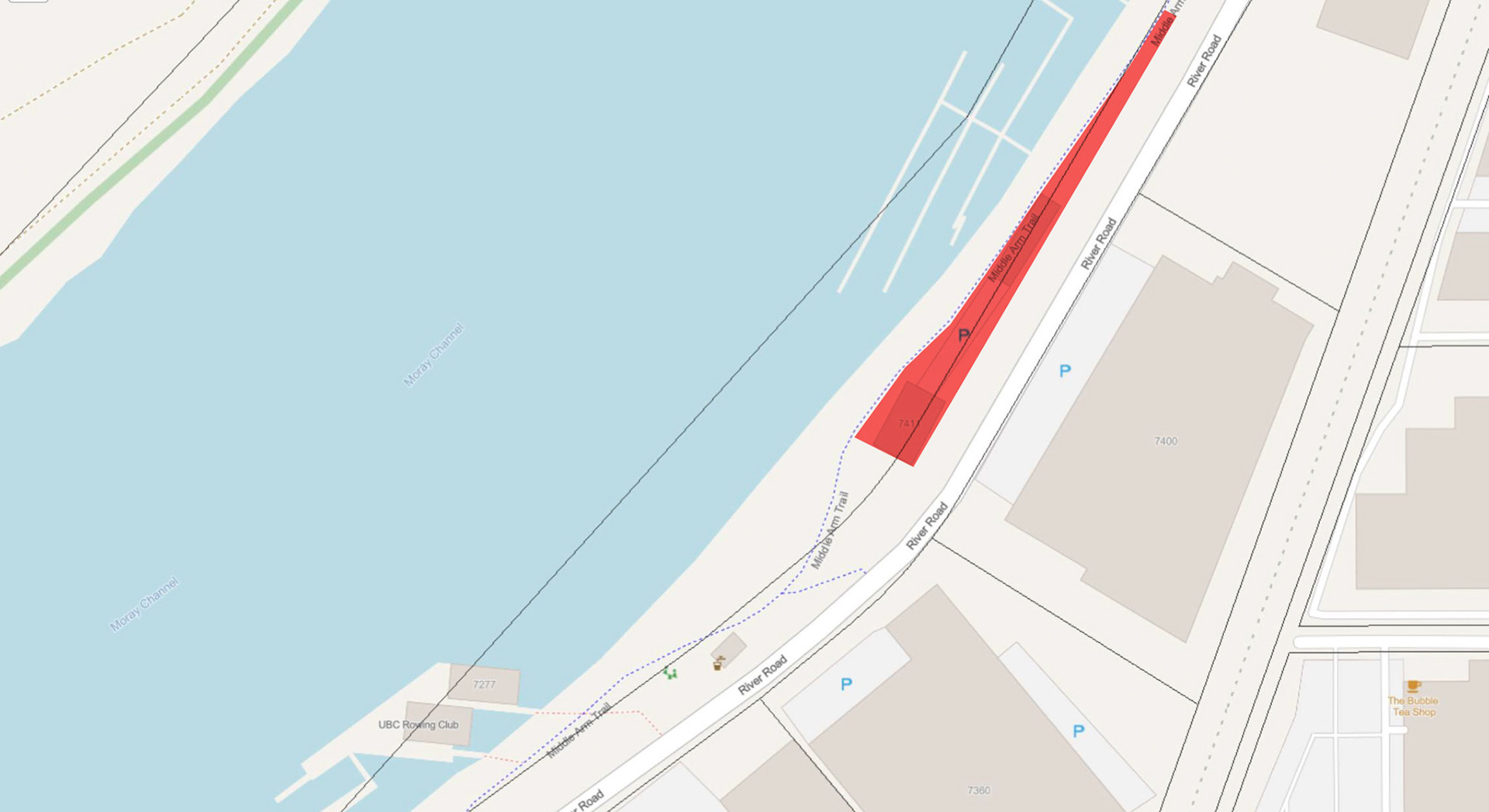
ABOVE || Aerial of Scotch Pond
Showing site features, landscape barriers, water barriers, and primary path of entry.
Showing site features, landscape barriers, water barriers, and primary path of entry.
The site is 'divided' into 3 spaces:
Sturgeon Banks marshlands,
Scotch Pond, and
Garry Point Park.
Sturgeon Banks marshlands,
Scotch Pond, and
Garry Point Park.